
Understanding local zoning regulations is one of the most critical steps in evaluating vacant land for purchase. Zoning laws govern how a piece of property can be used, what types of structures can be built on it, and the operational limitations imposed on landowners. A parcel of land might look ideal for your intended purpose, whether that is building a primary residence, starting a small agricultural homestead, operating a commercial business, or placing a mobile home, but if local zoning codes prohibit that specific use, the property becomes virtually useless for your goals.
Navigating municipal zoning requires moving beyond basic property listings to analyze county master plans, zoning maps, municipal ordinance codes, and variance procedures. By systematically auditing zoning designations, building setback rules, density limits, and permitted use tables during your due diligence window, you can avoid costly regulatory mistakes, protect your investment capital, and ensure your vision aligns perfectly with local government rules.
The Core Foundations and Purpose of Municipal Zoning Laws
Zoning is a regulatory framework established by local municipal governments, such as counties, cities, towns, or townships, to control the physical development and use of land within their jurisdictional borders. The primary goal of zoning is to promote public safety, protect property values, and ensure orderly community growth by separating incompatible land uses.
Local planning commissions divide geographic areas into distinct zoning districts. Each district carries specific legal rules regarding allowed building footprints, structural heights, lot coverage percentages, and permitted activities. For example, zoning prevents industrial chemical plants from operating inside quiet residential neighborhoods or heavy commercial shopping centers from encroaching on agricultural preserves.
Understanding these foundational concepts is essential because zoning regulations carry the full force of local law. Violating municipal zoning codes can result in severe daily fines, mandatory demolition of unapproved structures, or permanent stop-work orders issued by county building officials.
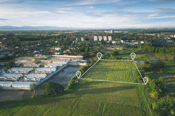
Primary Zoning Classifications and Their Functional Rules
Municipalities categorize land into several broad zoning classifications, each containing specialized sub-districts tailored to specific density levels and operational uses. Recognizing these classifications helps you narrow your property search effectively.
Residential zoning districts focus primarily on housing structures, ranging from low-density single-family rural zones to high-density multi-family apartment classifications. Commercial zoning permits retail stores, professional offices, dining establishments, and service businesses. Industrial zones accommodate manufacturing facilities, warehousing hubs, and heavy processing operations.
Agricultural zoning districts protect farming, forestry, and open space, offering flexible land use options but often imposing strict limits on secondary residential density. Specialized classifications, such as recreational, timberland, or mixed-use zones, balance conservation goals with controlled commercial or residential activities.
Comparative Matrix of Standard Municipal Zoning Classifications
Different zoning categories dictate what activities and structures are legally permitted on a parcel. The table below outlines standard municipal zoning classifications, their primary permitted uses, and common development restrictions:
| Zoning Classification | Primary Permitted Land Uses | Standard Development Restrictions |
| Single-Family Residential (R-1) | Single-family homes, accessory dwelling units, parks | Strict setback rules, limits on livestock, no commercial ops |
| Agricultural Preserve (AG) | Farming, timber harvesting, primary homesteads | High minimum lot sizes, limits on residential density |
| Commercial District (C-1) | Retail shops, professional offices, service businesses | High parking ratios, noise controls, limited residential builds |
| Light Industrial (I-1) | Warehousing, manufacturing, distribution centers | Mandatory buffer zones from residential lots, traffic limits |
| Mixed-Use Overlay (MU) | Combined residential and light commercial spaces | Complex architectural design standards, strict parking ratios |
Reviewing these broad classifications provides an initial filter, but you must inspect specific local ordinance text to confirm exact rules for candidate parcels.
Permitted Uses, Conditional Uses, and Prohibited Activities
Within every zoning sub-district, local ordinance codes categorize land activities into three distinct regulatory tiers: permitted uses, conditional uses, and prohibited uses.
A permitted use, often called use by right, is an activity explicitly allowed within the zoning district without requiring special municipal approvals. If your project falls under a permitted use, you simply submit standard building plans to receive construction permits, provided your design meets dimensional setback and height requirements.
A conditional use, or special exception, represents an activity that may be allowed within the zoning district, but only after formal review and approval by the local planning board or zoning board of adjustment. Obtaining a conditional use permit requires public hearings, neighbor notifications, and meeting specific site conditions imposed by the board. Prohibited uses are activities explicitly banned within the zoning district, requiring a formal zoning variance or legislative re-zoning amendment to proceed.
Dimensional Setbacks, Lot Coverage, and Height Restrictions
Zoning laws regulate far more than just how land is used; they dictate the precise spatial footprint and physical dimensions of any structure built on the property. Failing to account for these dimensional rules can severely shrink your usable building area.
Setback requirements define the minimum mandatory distance between a structure and the property lines. Municipal codes establish specific front, side, and rear yard setbacks. For example, a parcel might feature a fifty-foot front setback from the road centerline, a twenty-foot side setback from adjacent lots, and a thirty-foot rear setback. These buffer zones create an invisible interior perimeter known as the buildable envelope.
Lot coverage limits dictate the maximum percentage of total property area that can be covered by impermeable surfaces, including rooflines, concrete foundations, driveways, and patios. Furthermore, maximum building height restrictions limit vertical construction, ensuring structures do not block sunlight, views, or emergency fire equipment.
Dimensional Standards Matrix across Zoning Sub-Districts
Understanding how dimensional rules vary across zoning categories helps you calculate true buildable space. The table below illustrates typical dimensional standards found across different rural and suburban sub-districts:
| Sub-District Classification | Typical Minimum Lot Size | Standard Building Setbacks | Maximum Lot Coverage Limit |
| Rural Residential (RR-5) | 5 Acres | 50 ft Front, 25 ft Side, 30 ft Rear | 10 percent to 15 percent total lot area |
| Suburban Residential (R-2) | 0.5 Acres | 30 ft Front, 10 ft Side, 20 ft Rear | 30 percent to 40 percent total lot area |
| General Agricultural (A-1) | 10 to 40 Acres | 100 ft Front, 50 ft Side, 50 ft Rear | 5 percent to 10 percent total lot area |
| Highway Commercial (C-2) | 1 Acre | 40 ft Front, 15 ft Side, 25 ft Rear | 50 percent to 70 percent total lot area |
Comparing these dimensional metrics against physical lot boundaries prevents purchasing a property where mandatory setback lines overlap your desired building footprint.

Evaluating Zoning Overlays, Floodplains, and Environmental Buffers
In addition to base zoning classifications, municipal governments often apply zoning overlay districts to protect specialized environmental, historical, or safety resources. Overlay rules apply additional regulatory requirements on top of underlying base zoning.
Environmental overlay zones are extremely common on vacant land. Critical area overlays, wetland protection buffers, and steep-slope restrictions enforce extra setback rules around natural features. For example, a state environmental overlay might mandate a one-hundred-foot undeveloped buffer zone around streams or seasonal wetlands, prohibiting soil grading or tree clearing within that corridor.
Floodplain overlay zones, managed in coordination with Federal Emergency Management Agency mapping, restrict construction within designated 100-year flood hazard areas. Building in flood overlays requires elevated foundation designs, specialized civil engineering, and mandatory flood insurance. Catching overlay restrictions during due diligence prevents buying land with unexpected environmental building barriers.
Navigating Non-Conforming Uses, Variances, and Re-Zoning
When researching property, you may encounter parcels that do not align with current zoning rules or require specialized exceptions to fulfill your project goals. Navigating these scenarios requires understanding municipal administrative procedures.
A legal non-conforming use, commonly called grandfathered status, occurs when a property was legally established under older zoning rules, but current codes have since changed. While grandfathered uses can generally continue, municipal codes usually prevent expanding non-conforming structures, rebuilding them after significant damage, or resuming the non-conforming activity if operations cease for a specified period.
If your intended project violates current dimensional rules slightly, you can apply for a zoning variance. An area variance grants relief from strict setback or height limits based on unique physical land hardship, such as steep rock outcroppings. A use variance seeks permission to operate an unpermitted land activity, which requires proving that strict code enforcement deprives the owner of all reasonable economic value. Re-zoning involves formally petitioning the county board to change a parcel’s underlying zoning designation, a complex legislative process requiring public notice, community meetings, and municipal board approval.
Step-by-Step Method for Verifying Zoning Before Buying Land
To ensure complete regulatory compliance before releasing contract purchase contingencies, follow this systematic step-by-step zoning verification framework:
- Obtain the Assessor Parcel Number: Locate the exact parcel identification number and legal description from county land records or sales contracts.
- Inspect County Zoning Maps: Cross-reference the parcel APN against the official municipal zoning map to identify its exact base zoning classification and overlay districts.
- Review Ordinance Text: Read the specific municipal zoning ordinance chapter for that classification, auditing permitted use tables, conditional requirements, and prohibited activities.
- Calculate the Buildable Envelope: Subtract mandatory front, side, and rear setback lines, utility easements, and environmental buffers from total parcel dimensions.
- Secure Written Municipal Confirmation: Request a formal Zoning Verification Letter from the county planning department confirming that your explicit land use plans are legally permitted on the site.
Executing this thorough step-by-step audit process eliminates regulatory guesswork and provides written documentation to support your land purchase decision.
Checking Covenants, Conditions, and Restrictions Alongside Zoning
A major error made by land buyers is assuming that municipal zoning represents the only set of land use rules governing a parcel. Private contractual restrictions can impose rules that are far stricter than county zoning codes.
Covenants, Conditions, and Restrictions, known as CC&Rs, are private legal contracts recorded against property deeds, often managed by Homeowners Associations or developer covenants. While county zoning might permit livestock, accessory structures, mobile homes, or solar panel arrays, private CC&Rs can strictly prohibit them.
Public zoning laws and private CC&Rs operate independently. Local county planning departments do not enforce private HOA covenants, and HOAs cannot override public zoning laws. In practice, the strictest rule always applies. If county zoning permits a pole barn but private deed covenants ban outbuildings, the private covenant controls your ability to build. Always review recorded CC&Rs alongside public zoning files during due diligence.

Working with Planning Boards, Zoning Officers, and Legal Experts
Verifying complex zoning regulations requires building positive working relationships with municipal planning staff and consulting experienced real estate professionals who understand local land use law.
Visit the local county planning and zoning office in person during your feasibility inspection period. Schedule a meeting with a staff planner to discuss your proposed site plan. Local planners can provide valuable context regarding unwritten departmental interpretations, upcoming master plan changes, historic variance approval rates, and community opposition trends that desktop research cannot reveal.
If your project requires a conditional use permit, variance, or formal re-zoning petition, retain a local real estate attorney or civil engineering consultant who regularly appears before the local planning board. Experienced local professionals know how to navigate administrative hearing procedures, present convincing site testimony, and secure municipal approvals efficiently.
Conclusion
Understanding zoning regulations before purchasing vacant land is essential for protecting your capital and ensuring your project vision becomes reality. By analyzing municipal zoning maps, reviewing ordinance text, calculating dimensional buildable envelopes, and identifying environmental overlay districts, you eliminate regulatory risk. Always remember to cross-reference public zoning codes against private recorded deed covenants to ensure complete compliance. Taking a disciplined, methodical approach to zoning due diligence empowers you to acquire land with confidence, knowing that your planned use is fully legal, buildable, and protected for years to come.
Frequently Asked Questions
What is a Zoning Verification Letter and why do I need one?
A Zoning Verification Letter is an official document issued by a municipal planning department that confirms a parcel’s current zoning classification, permitted land uses, and whether existing structures comply with local codes. Obtaining this letter during due diligence provides written proof from the government that your planned project is legally allowed on the site.
Can I build a house on land zoned for agricultural use?
In most agricultural zoning districts, building a primary single-family residence is permitted as an accessory homestead to farming operations. However, agricultural zones often enforce high minimum lot size requirements, such as 10 to 40 acres per dwelling, and strictly limit secondary residential density or subdivision splits.
What is the difference between a zoning variance and a conditional use permit?
A conditional use permit allows an activity that is explicitly listed as acceptable in the zoning code, provided the owner meets specific operational conditions imposed by the board. A zoning variance grants an exception to strict code rules for a use or structure that is otherwise prohibited or non-compliant, requiring proof of unique physical land hardship.
How do environmental overlay zones affect building plans on vacant land?
Environmental overlay zones impose additional restrictive rules on top of base zoning to protect resources like wetlands, steep slopes, or floodplains. Overlays can expand mandatory building setbacks, restrict tree clearing, require specialized civil engineering plans, and reduce the total buildable area of a parcel significantly.
What happens if I use my land in violation of local zoning codes?
Using land in violation of local zoning codes can result in formal code enforcement actions, including daily monetary fines, injunctions, mandatory removal or demolition of unapproved structures, and legal action by municipal attorneys. Code enforcement citations can cloud property title and halt all site development indefinitely.