
Preparing vacant land for future development is a comprehensive, multi-disciplinary process that transforms raw, uncultivated terrain into an engineered, shovel-ready site capable of supporting commercial, industrial, or residential construction. While real estate acquisitions often center on location, purchase price, and long-term submarket demographics, the financial feasibility of a development project depends heavily on horizontal site preparation. Converting raw land into buildable acreage requires resolving physical land constraints, securing legal municipal entitlements, completing environmental remediation, and constructing essential utility and transportation infrastructure.
Without meticulous site preparation, unexpected subsurface conditions, delayed utility connections, or unmanaged storm water liabilities can quickly consume profit margins, derail project timelines, and disrupt institutional financing. A structured site preparation framework ensures that developers identify technical risks early, manage capital expenditures efficiently, and establish a stable physical foundation for vertical construction. By coordinating land surveyors, civil engineers, environmental specialists, and municipal planning officials, developers can successfully mitigate horizontal construction risks and maximize land value.
The Strategic Objectives of Horizontal Site Development
Horizontal development establishes the essential base layer for all subsequent vertical construction activities. Unlike vertical building construction, which focuses on structural framing, architectural design, and interior fit-outs, horizontal site development addresses earthworks, subgrade stability, environmental safety, and infrastructure integration.
The primary objective of site preparation is to transform unpredictable natural land conditions into a controlled, uniform construction surface that complies with municipal codes and structural engineering standards. This transition requires clearing surface vegetation, balancing topsoil through grading operations, installing subterranean utility systems, and managing site hydrology. Every square foot of land must be engineered to bear anticipated structural loads while safely directing storm water away from future foundations and neighboring properties.
Site Preparation Sequence: Regulatory Entitlements -> Site Clearing & Grubbing -> Mass Earthwork & Grading -> Infrastructure & Utilities -> Base Surface Ready
In addition to physical site enhancements, horizontal development serves as the critical risk-reduction phase for real estate investments. Securing permits, completing environmental remediations, and bringing utilities directly to parcel boundaries eliminates major development uncertainties. Shovel-ready parcels command significant market premiums because buyers and end-user tenants can bypass long municipal approval cycles and begin vertical construction immediately.
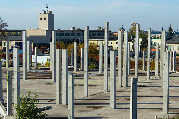
Initial Site Surveys, Boundary Assessments, and Topography Mapping
The site preparation process begins with establishing precise physical boundaries, identifying encumbrances, and mapping natural terrain features through comprehensive professional surveys.
A licensed land surveyor must conduct an extensive boundary and topographic survey before any heavy machinery touches the site. The boundary survey verifies exact legal property lines, locates physical monuments, and identifies recorded public utility easements, access rights-of-way, or structural encroachments. Developing over an unrecorded easement or encroaching past property lines can lead to mandatory structural demolitions, costly legal disputes, and immediate project shutdowns.
Land Survey Protocol: Title Record Audit -> Boundary Marker Verification -> Topographic Contour Mapping -> Utility Easement Identification
Topographic surveys generate precise contour maps that illustrate elevation changes, natural drainage paths, slope gradients, and prominent physical features across the parcel. Civil engineers rely on these topographic maps to calculate cut-and-fill dirt balances, design gravity-fed sanitary sewer lines, and formulate effective storm water management plans. Accurately mapping terrain features helps minimize the need to import expensive off-site fill dirt or haul excess soil away from the parcel during grading operations.
Overview of Essential Technical Site Preparation Surveys
Executing specialized pre-construction surveys enables developers to evaluate physical land characteristics, uncover hidden subsurface risks, and establish precise design guidelines:
| Survey Type | Primary Data Collected | Technical Objective for Site Preparation |
| Boundary & ALTA/NSPS Survey | Exact property lines, access points, easements, encroachments, rights-of-way | Define legal site boundaries and identify restricted building areas |
| Topographic Survey | Elevation contours, slope gradients, natural drainage corridors, physical features | Calculate earthwork cut-and-fill requirements and design storm water systems |
| Geotechnical Soil Survey | Soil bearing capacity, depth to bedrock, subterranean water table, shrink-swell potential | Determine structural foundation designs and necessary soil stabilization methods |
| Wetland Delineation Survey | Environmental boundaries of protected wetlands, high-water marks, hydric soils | Establish mandatory environmental buffer zones and secure regulatory permits |
Conducting these surveys during initial due diligence ensures that physical site realities align with proposed architectural and civil engineering designs.
Environmental Remediation, Clearing, and Demolition
Before heavy earthwork machinery begins mass grading, parcels must be cleared of environmental hazards, surface vegetation, organic debris, and legacy structures.
Environmental site preparation begins by addressing issues identified during preliminary Phase I and Phase II Environmental Site Assessments (ESA). If a property contains historical industrial contamination, leaking underground storage tanks, or hazardous agricultural chemical residues, developers must complete formal environmental remediation under local and state regulatory oversight. Remediation activities may include excavating contaminated soil, installing groundwater monitoring wells, or capping affected areas to prevent contaminant migration.
Site Clearing Protocol: Hazardous Material Removal -> Structure Demolition -> Vegetation Clearing -> Tree Root Grubbing
Once environmental safety is confirmed, land clearing and grubbing operations commence. Clearing involves removing surface trees, brush, boulders, and organic surface debris across designated building footprints and access corridors. Grubbing targets subterranean root structures and organic topsoil layers. Leaving tree roots or organic matter beneath building footprints creates severe long-term risks, as decaying organic matter leaves subterranean voids that cause soil settlement, foundation cracking, and structural failure.
Mass Earthwork, Subgrade Stabilization, and Grading Operations
Mass earthwork transforms natural terrain into engineered subgrades capable of supporting heavy structural loads and paved vehicular surfaces.
Grading contractors utilize heavy machinery, including bulldozers, excavators, and motor graders, to cut down high points on the parcel and fill low-lying areas. Civil engineers design grading plans around a balanced earthwork concept, aiming to match the volume of excavated soil (cut) with the volume of soil required for fill areas (fill). Achieving a balanced cut-and-fill ratio minimizes project expenses by eliminating the need to buy off-site soil or pay disposal fees for excess dirt.
Mass Earthwork Cycle: Topsoil Stripping -> High-Point Cutting -> Low-Point Filling -> Soil Compaction Testing
Subgrade soil stability is critical to structural performance. Expansive clay soils, saturated silts, or uncompacted fill materials cannot safely support heavy commercial foundations. Geotechnical engineers supervise subgrade preparation, enforcing strict soil compaction standards. Structural fill dirt must be placed in controlled horizontal layers, known as lifts, and compacted using heavy rollers to achieve specified density targets, such as ninety-five percent of maximum dry density. In areas with weak native soils, contractors apply chemical stabilization agents like lime or Portland cement, or install synthetic geotextile fabrics to reinforce the subgrade.
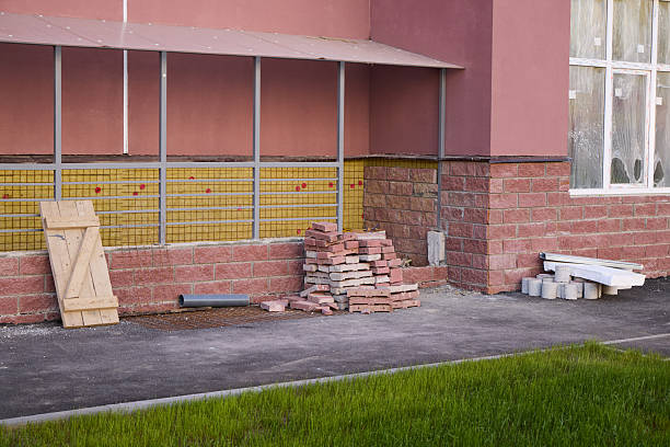
Storm Water Management, Erosion Control, and Hydrology Systems
Managing site hydrology during and after construction protects neighboring properties, prevents soil erosion, and ensures compliance with environmental regulations.
During active land preparation, exposed soil is highly susceptible to wind and water erosion. Municipalities require developers to implement formal Stormwater Pollution Prevention Plans (SWPPP) before disturbing the ground. Temporary erosion control measures include installing silt fences along site perimeters, placing rock check dams in drainage channels, establishing temporary sediment retention basins, and applying hydroseed or straw mulch to exposed soil slopes. Maintaining these controls prevents sediment runoff from choking local storm sewers, rivers, and protected wetlands.
Hydrology Control Sequence: Perimeter Silt Fencing -> Temporary Retention Basins -> Underground Pipe Network -> Permanent Retention Ponds
Permanent storm water management infrastructure must be engineered to handle increased runoff volumes caused by non-permeable surfaces like building roofs, concrete walkways, and paved parking lots. Developers build retention or detention ponds, underground storm water storage vaults, catch basins, and bio-retention swales. Retention ponds retain water permanently while allowing controlled percolation, whereas detention basins hold storm water temporarily during heavy rain events and release it at controlled flow rates into municipal drainage networks.
Infrastructure Installation: Utilities, Roads, and Site Access
Connecting raw land to modern utility networks and transportation infrastructure is one of the most complex aspects of horizontal site preparation.
Utility installation begins deep underground before surface paving operations start. Main utility networks include potable water mains, sanitary sewer lines, natural gas pipes, electric power conduits, and fiber-optic telecommunications infrastructure. Underground pipes must be installed at specific slope gradients and depths to ensure gravity flow for sewage while protecting water lines from freezing. Coordinating utility installations requires precise scheduling among civil contractors, municipal utility departments, and private utility companies to avoid utility line strikes and minimize trenching delays.
Subterranean Utility Sequence: Deep Sanitary Sewer Laying -> Potable Water Main Installation -> Gas Line Trenching -> Electrical & Fiber Conduit Placement
Transportation infrastructure development establishes safe access for construction vehicles, service equipment, and future traffic. Building internal access roads involves excavating the roadway subgrade, placing compacted aggregate base rock, and laying durable asphalt or concrete surface courses. Furthermore, developers must construct approved public road access points, which often require installing dedicated turn lanes, curb cuts, drainage culverts, and traffic signals to comply with municipal and state transportation standards.
Comparative Matrix of Utility Infrastructure Delivery Systems
Analyzing different utility delivery mechanisms helps developers evaluate costs, installation complexities, and long-term service reliability:
| Utility Infrastructure System | Installation Depth & Gradient Requirements | Primary Horizontal Construction Challenge | Regulatory & Utility Coordination Needs |
| Sanitary Sewer System | Deep underground installation with precise gravity-fed slope gradients | Maintaining accurate pipe slope across variable site topography | Municipal sanitary district approvals and capacity verification |
| Potable Water Lines | Installed below regional frost lines with specified pressure standards | Achieving required water main flow rates for commercial fire suppression | Public health department oversight and backflow prevention rules |
| Underground Electric & Fiber | Shallow to moderate depth installed within protective PVC conduits | Coordinating trenching routes with wet utilities to prevent line conflicts | Private power and telecommunications provider joint-trench agreements |
| Storm Water Drainage Network | Variable depths connecting catch basins to retention structures | Managing heavy surface runoff volumes during active trench excavation | Environmental protection agency SWPPP permits and municipal storm reviews |
Evaluating these utility systems early enables development teams to create accurate horizontal construction budgets and avoid costly field modifications.
Technical Risk Management and Inspections During Site Preparation
Conducting systematic inspections during horizontal site preparation helps developers identify subsurface issues early, verify engineering compliance, and control project budgets. The following matrix outlines common site preparation challenges, underlying risk factors, and necessary mitigation steps:
| Technical Warning Indicator | Underlying Site Constraint | Recommended Remediation Verification Action |
| Unstable Soil Compaction Test | High moisture content or presence of uncompacted organic material | Execute soil drying, apply lime stabilization, or undercut and backfill with engineered aggregate |
| High Subterranean Water Table | Shallow groundwater interfering with utility trenching and foundations | Install temporary dewatering wells, subterranean French drains, or continuous pumping systems |
| Unexpected Underground Voids | Unrecorded buried debris, legacy septic tanks, or karst limestone sinkholes | Excavate hidden debris, backfill voids with flowable concrete fill, and perform soil compaction tests |
| Erosion Silt Fence Blowout | Excessive storm water runoff overwhelming temporary sediment barriers | Repair perimeter silt fencing, re-grade drainage channels, and expand sediment retention basins |
Addressing these technical challenges during horizontal site preparation ensures the parcel is physically ready for vertical construction.
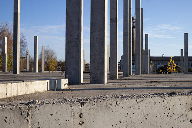
Assembling the Horizontal Site Development Team
Preparing vacant land for future development requires coordinating a specialized team of legal, engineering, and environmental professionals.
The development team is managed by a project manager who oversees civil engineers, land surveyors, geotechnical specialists, and environmental consultants. The civil engineer plays a central role by designing site grading plans, utility networks, storm water retention systems, and road layouts, while serving as the primary technical contact during municipal plan reviews. The geotechnical engineer evaluates subsurface soil conditions, specifies soil compaction standards, and conducts field density tests during earthwork operations.
Development Team Structure: Project Developer -> Civil & Geotechnical Engineers -> Environmental Consultants -> Heavy Horizontal Contractors
Legal and regulatory compliance is guided by land-use attorneys who review title commitments, audit utility easements, and secure municipal planning approvals. Heavy civil contractors execute the physical work on-site, operating specialized earthmoving machinery, trenchers, and paving equipment. Establishing clear communication among all team members ensures that site preparation stays on schedule, complies with regulatory standards, and remains within budget.
Conclusion
Preparing vacant land for future development is a multi-step process that transforms raw acreage into a secure, shovel-ready site for vertical construction. Horizontal site development requires balancing legal entitlements, environmental protection, civil engineering, and infrastructure installation. By executing comprehensive boundary and topographic surveys, completing necessary environmental remediations, performing controlled earthworks, and installing robust storm water and utility networks, developers create a solid foundation for future construction. Investing time and capital into thorough site preparation reduces development risks, protects profit margins, and ensures the long-term success of commercial real estate projects.
Frequently Asked Questions
What does it mean for land to be in shovel-ready condition?
Shovel-ready land has completed all preliminary site preparation, zoning approvals, environmental clearances, and infrastructure connections. Developers can secure vertical building permits and begin structural construction immediately without delays from horizontal site preparation or municipal entitlement reviews.
Why is a geotechnical soil borings test necessary before site preparation?
Geotechnical soil borings collect subsurface soil samples to evaluate soil bearing capacity, moisture levels, depth to bedrock, and groundwater tables. Structural engineers rely on this data to design safe building foundations, determine soil compaction requirements, and identify necessary soil stabilization methods.
What is the difference between a cut-and-fill operation in mass earthwork?
Cut-and-fill operations balance site topography during grading. Cutting involves excavating soil from high-elevation areas, while filling involves placing and compacting that excavated soil into low-lying areas. Achieving a balanced cut-and-fill ratio avoids the extra expense of importing or exporting soil.
What is a Stormwater Pollution Prevention Plan (SWPPP)?
A Stormwater Pollution Prevention Plan (SWPPP) is an environmental management plan required by regulatory agencies during construction. It outlines specific erosion and sediment control measures, such as silt fences, sediment basins, and surface mulching, to prevent polluted runoff from washing into local waterways.
How do utility easements affect horizontal land preparation?
Utility easements grant utility companies legal access to construct and maintain infrastructure across specific portions of a property. These designated areas restrict building locations, as permanent structures cannot be built over utility easements, impacting overall site design and grading plans.