
Acquiring unimproved land in New Jersey presents prospective real estate buyers with exceptional value creation potential, strategic location benefits, and long-term equity growth. Known as the Garden State, New Jersey occupies a premier geographic position within the Mid-Atlantic corridor, nestled between major metropolitan financial centers in New York City and Philadelphia. The state offers diverse natural environments, ranging from protected highland ridges and fertile agricultural valleys in the northwest to dense pine forests, suburban residential subdivisions, and vibrant Atlantic coastal shorelines. Whether your vision involves constructing a luxury custom estate in Somerset County, establishing an agricultural vineyard in Hunterdon County, building a coastal residence in Monmouth County, or securing commercial acreage along key transport arteries, purchasing raw land in New Jersey requires navigating a sophisticated market environment.
While owning vacant acreage in New Jersey carries strong long-term appreciation, acquiring parcel lots demands detailed technical due diligence. New Jersey is the most densely populated state in the nation, making buildable land scarce and development oversight extensive. Real estate development across the state is governed by municipal planning boards operating under statutory land use frameworks, alongside state environmental protection policies. Essential factors including specialized regional planning zones such as the Highlands Preservation Area and the Pinelands Reserve, local health department septic rules under state environmental codes, legal road frontage requirements, and preferential Farmland Assessment tax programs directly dictate site feasibility and project budgets. Establishing a disciplined evaluation procedure enables land buyers to identify buildable parcels, manage development timelines, and achieve successful acquisition outcomes.
Regional Geographic Sub-Markets and Terrain Across New Jersey
The real estate landscape across New Jersey is divided into distinct geographic sub-regions, each characterized by specific soil characteristics, land pricing metrics, and regulatory oversight. Identifying these regional sub-markets enables property buyers to select locations that match their capital budgets and project goals.
Northwestern New Jersey, encompassing Sussex, Warren, Hunterdon, and western Morris counties, represents the state’s rural and agricultural heartland. Characterized by Appalachian ridges, river valleys, and rolling farmland, this region offers expansive acreage parcels suited for agricultural production, custom rural homes, and conservation holdings. Land prices here are moderate compared to urban suburbs, though development is governed by strict water resource rules under the Highlands Water Protection and Planning Act. The North Jersey Suburban Belt, spanning Bergen, Passaic, Essex, Union, and eastern Morris counties, serves as a high-density commuter corridor for New York City. Vacant land in this sector is limited, consisting primarily of infill lots, teardown properties, and luxury estate subdivisions, resulting in exceptionally high price metrics per acre.
Central New Jersey, including Somerset, Middlesex, Mercer, and northern Monmouth counties, offers a vibrant mix of suburban communities, research hubs, and historic farmland. Soil conditions feature fertile loam, and land demand remains strong due to commercial corridors along Interstate 95 and Interstate 287. Moving south, Coastal New Jersey spans Eastern Monmouth, Ocean, Atlantic, and Cape May counties along the Atlantic shore. Land values in coastal towns are driven by resort development, with real estate subject to coastal environmental oversight. Finally, Southern and Southwestern New Jersey, comprising Burlington, Camden, Gloucester, Salem, and Cumberland counties, contains expansive agricultural fields and the vast Pinelands National Reserve. Featuring sandy acidic soils and flat topography, South Jersey provides affordable per-acre prices for agricultural operations, solar development, and residential housing.
Local Municipal Governance, Home Rule, and Zoning Bylaws
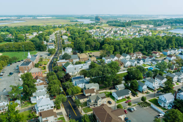
Understanding real estate development in New Jersey requires recognizing that land-use regulation is controlled entirely by the state’s 564 individual municipal cities, townships, boroughs, and villages. County governments in New Jersey provide minimal planning oversight, leaving direct land-use authority in the hands of local municipal governing bodies.
Local land development across New Jersey is governed strictly by the Municipal Land Use Law, codified under N.J.S.A. 40:55D-1 et seq. Under this statutory framework, each municipality establishes a local Master Plan, enacts local zoning ordinances, and appoints an autonomous Planning Board and Zoning Board of Adjustment. Local zoning ordinances establish precise rules governing allowable land uses, minimum lot sizes, maximum lot coverage percentages, floor area ratios, building heights, and structural setbacks from front, side, and rear property lines. Zoning Boards of Adjustment retain statutory power to evaluate application requests for use variances and dimensional variances under N.J.S.A. 40:55D-70 when physical site limitations prevent strict compliance with local zoning rules.
Because land regulations are crafted at the municipal level under New Jersey’s strong home rule tradition, development standards vary substantially across neighboring town boundaries. A residential parcel might require a minimum lot size of one half-acre in a suburban Middlesex County township, while a neighboring township in Somerset County mandates a minimum of three to five acres per single-family lot. Furthermore, municipalities enforce specialized local overlay districts, including steep slope protection ordinances, historic preservation guidelines, and tree removal regulations. Engaging with local zoning officers, planning board secretaries, and municipal engineers during due diligence is essential to verify lot buildability.
Strategic Breakdown of New Jersey Regional Land Markets
Evaluating primary regional land markets across New Jersey provides essential insight regarding infrastructure, market drivers, and regulatory complexity. The table below outlines key market parameters across the primary sub-regions of the Garden State:
| Regional Zone | Target Land Utilities | Primary Value Drivers | Key Environmental & Regulatory Factors |
| Northwestern Highlands | Rural homesteads, agricultural farms, timberland, country estates | Moderate per-acre pricing, scenic ridges, mountain views | Highlands Act preservation rules, steep slope bylaws, septic limits |
| North Jersey Suburban Belt | Custom infill housing, luxury residential estates, commercial sites | Proximity to NYC, dense population, high per-acre equity | MLUL zoning density limits, municipal site plan reviews, stormwater rules |
| Central & Coastal Corridor | Suburban developments, commercial logistics, coastal retreats | Strong commuting routes, high tourism, commercial demand | CAFRA coastal permits, local floodplain bylaws, sewer service mapping |
| Southern & Pinelands Region | Active agriculture, solar farms, low-density residential | Low purchase price per acre, large tracts, flat terrain | Pinelands Comprehensive Management Plan, sandy soil perc rules |
Selecting the appropriate regional zone ensures that prospective property buyers balance capital expenditures against local regulatory schedules and infrastructure requirements.
State Environmental Oversight: Highlands, Pinelands, CAFRA, and Wetlands
Environmental protection of raw land in New Jersey operates under some of the most comprehensive statutory programs in the United States, administered primarily by the New Jersey Department of Environmental Protection (NJDEP) alongside regional environmental commissions.
The Highlands Water Protection and Planning Act, codified under N.J.S.A. 13:20-1 et seq., regulates development across 859,000 acres in northwestern New Jersey to safeguard public water supplies. The statute splits the region into a Preservation Area and a Planning Area. Within the Preservation Area, land clearing, impervious coverage, and construction are heavily restricted, requiring specialized Highlands Preservation Area Approvals from the NJDEP. In southern New Jersey, the Pinelands Protection Act under N.J.S.A. 13:18A-1 et seq. governs over one million acres of sensitive forest and groundwater resources. Managed by the Pinelands Commission under the Pinelands Comprehensive Management Plan, land is categorized into management zones including Forest Areas, Agricultural Production Areas, and Regional Growth Areas. Development density is tightly regulated, often requiring Pinelands Development Credits to build residential units.
Along the oceanfront and tidal bays, the Coastal Area Facility Review Act, known as CAFRA under N.J.S.A. 13:19-1 et seq., regulates construction activities, coastal dune disturbance, and coastal bank alterations. CAFRA permits are enforced by the NJDEP Division of Land Resource Protection based on environmental impact and coastal flooding hazards. Inland throughout the state, the New Jersey Freshwater Wetlands Protection Act under N.J.S.A. 13:9B-1 et seq. protects wetlands, rivers, and streams. Under state law, NJDEP enforces mandatory transition areas, or buffer zones, extending 50 feet around intermediate resource value wetlands and 150 feet around exceptional resource value wetlands. Proposed activity within a wetland or buffer zone requires filing a Letter of Interpretation and securing a Freshwater Wetlands General Permit or Individual Permit. Conducting environmental screening during contract due diligence prevents acquiring restricted land.
Subsurface Wastewater Disposal and NJDEP Septic Permitting
In rural and suburban areas of New Jersey where municipal centralized sewer lines are unavailable, parcel buildability depends on securing health department approvals for an individual subsurface sewage disposal system, commonly known as a septic system. Septic design, installation, and permitting across the state are governed strictly by NJDEP regulations under N.J.A.C. 7:9A, titled Standards for Individual Subsurface Sewage Disposal Systems.
Local administrative health authorities, operating through municipal or county health departments, administer state septic standards. Before a building permit can be issued for new residential construction, the lot owner must obtain a site plan approval and septic system construction permit from the local health authority. Achieving system approval requires conducting thorough field testing, including deep soil log excavations and soil permeability testing. Deep soil logs, excavated to a depth of at least nine feet, analyze soil horizons, identify restrictive hardpan layers, locate shallow ledge bedrock, and determine the maximum seasonal high groundwater table elevation. Permeability testing, performed via tube permeameter tests or percolation tests, measures the soil hydraulic absorption capacity.
If field testing reveals shallow bedrock, tight clay soils, or elevated seasonal water tables, traditional gravity-fed in-ground septic systems will be rejected. In these challenging soil conditions, a licensed professional engineer must design an advanced system, such as an engineered mounded disposal field, a pressure-dosed shallow disposal field, or a secondary advanced wastewater treatment unit. In sensitive environmental regions like the Pinelands or Highlands, septic approvals enforce strict nitrate dilution standards that limit building density per acre. Inserting a contract contingency requiring deep soil log testing and an approved health department septic plan protects buyers against unbuildable parcel investments.
Road Access, Frontage Requirements, and Subdivision Rules under MLUL
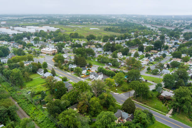
Securing legal and physical access is a critical requirement when purchasing raw land in New Jersey. Under municipal zoning bylaws and the Municipal Land Use Law, a vacant parcel must possess adequate legal continuous road frontage along an established, accepted public street to receive a valid building permit.
Municipal zoning ordinances specify minimum road frontage metrics, typically ranging from 100 feet in suburban single-family zones to over 300 feet in rural agricultural districts. If a parcel lacks required frontage along an accepted public street, constructing a residential dwelling requires obtaining a variance from the local Zoning Board of Adjustment under N.J.S.A. 40:55D-70(c), or constructing an approved public road extension at the developer’s expense. Furthermore, connecting a driveway to a local municipal street requires a driveway permit from the town public works department. If the parcel fronts a county road or state highway, access permits must be approved directly by the County Planning Board or the New Jersey Department of Transportation.
Dividing a large acreage parcel into smaller building lots is governed by the subdivision process under N.J.S.A. 40:55D-47. The MLUL distinguishes between minor subdivisions, which typically involve creating three or fewer lots without new road construction, and major subdivisions, which involve larger lot divisions or new infrastructure. Minor subdivisions require approval from the local Planning Board and recording of deeds or maps at the County Clerk office. Major subdivisions require preliminary and final site plan approvals, public hearings, utility installations, and performance guarantees. Verifying public road legal status and evaluating subdivision rules ensures smooth land development execution.
Technical and Environmental Due Diligence Matrix
Executing a structured technical due diligence process during the contract contingency period allows property buyers to systematically evaluate site risks. The table below provides an operational assessment matrix for analyzing vacant land in New Jersey:
| Assessment Metric | Low-Risk Site Profile | Elevated Risk Warning Sign | Essential Buyer Verification Action |
| NJDEP Septic Feasibility | Deep well-drained loamy soils; groundwater below 6 feet | High seasonal water table; shallow bedrock; tight clay | Perform deep soil log dig and perc tests supervised by local health department |
| Environmental Protection Zones | Site located fully outside Highlands Preservation or Pinelands | Parcel contains 150-foot wetland buffer, CAFRA zone, or Pinelands forest | File for NJDEP Letter of Interpretation and check regional commission mapping |
| MLUL Zoning & Frontage | Full required frontage on town-accepted public paved road | Access relies on private paper street or unmaintained easement | Review town zoning schedule and verify public road status with municipal engineer |
| Farmland Assessment Status | Property clear of tax liens; compliant agricultural activity | Recent unapproved land clearing or failure to file annual FA-1 form | Audit town tax assessor records and review 3-year rollback tax obligations |
Completing these technical evaluations ensures buyers navigate state environmental laws effectively while securing marketable property rights.
Farmland Assessment Act (N.J.S.A. 54:4-23.1) and Rollback Tax Obligations
Holding large acreage parcels in New Jersey can involve substantial annual real estate tax obligations. Because New Jersey features high local property tax rates assessed on full market valuation, maintaining vacant unimproved land can become financially burdensome without tax relief.
To preserve active agricultural land and open space, New Jersey enacted the Farmland Assessment Act of 1964, codified under N.J.S.A. 54:4-23.1 et seq. Enrolling qualifying land under this statute allows property to be assessed for local property tax purposes based strictly on its agricultural productivity value rather than its full development market value. This preferential classification can reduce annual real estate tax assessments by up to ninety percent. To qualify for Farmland Assessment, a property owner must satisfy specific criteria: the land must comprise at least five contiguous acres actively devoted to agricultural or horticultural use, must have been devoted to farming for at least two consecutive years prior to the tax year, and must generate a minimum of $1,000 in gross annual agricultural sales for the first five acres, plus additional per-acre sales requirements for higher acreage. Woodland management plans certified by a licensed forester are required for non-appurtenant forestland.
However, purchasing or developing land enrolled in Farmland Assessment creates significant legal and financial responsibilities regarding rollback taxes under N.J.S.A. 54:4-23.8. When land enrolled in the program undergoes a change in use to residential or commercial development, it becomes subject to rollback taxes. Rollback taxes are levied for the tax year in which the use changes plus the two preceding tax years in which the land was assessed under farmland rates. The rollback tax represents the difference between the low farmland assessment taxes paid and the full market property taxes that would have been due over those three years. Land buyers purchasing Farmland Assessment property must structure contract terms to determine whether the seller or buyer satisfies rollback tax liabilities upon closing or land conversion.
Step-by-Step Acquisition Protocol for New Jersey Land Buyers
Adhering to a sequential acquisition protocol allows land buyers to navigate municipal bylaws, state agency approvals, and closing procedures efficiently:
- Define Property Utility and Select Target Regional Market: Establish clear project goals, such as building a residence, establishing a farm, or investing in commercial land, and choose a target New Jersey county.
- Review Municipal Zoning Ordinances and Dimensional Tables: Inspect local zoning maps, setback standards, building coverage limits, and road frontage rules under the Municipal Land Use Law.
- Perform Digital Environmental and Regional Zone Screening: Utilize NJDEP GeoWeb mapping tools to screen for freshwater wetlands, CAFRA coastal zones, Highlands Preservation Areas, and Pinelands boundaries.
- Structure a Purchase Contract with Technical Contingencies: Draft an offer with legal contingencies covering title search, boundary survey, NJDEP wetland delineation, and health department septic approvals.
- Conduct On-Site Septic Testing and Deep Soil Log Digs: Retain a licensed professional engineer and soil evaluator to perform deep soil log digs and permeability testing supervised by the local health department.
- Execute Field Wetland Delineation and Boundary Survey: Hire a certified environmental consultant to flag wetland boundaries and retain a licensed professional land surveyor to map property corners and contours.
- Address Farmland Assessment Rollbacks and Closing Mechanics: Engage an experienced New Jersey real estate attorney to search land records, review Farmland Assessment FA-1 filings, resolve rollback tax obligations, and execute the closing.
Executing this structured acquisition workflow protects earnest money deposits and confirms site development viability prior to final transaction execution.
Assembling Your Local Technical and Legal Advisory Team
Navigating the legal, environmental, and engineering complexities of purchasing raw land in New Jersey requires assembling a qualified team of local professionals familiar with state statutes and municipal procedures.
Your transaction team should be anchored by an experienced New Jersey real estate attorney. New Jersey is strictly an attorney-closing state, meaning legal counsel must perform title searches at the County Clerk office, review title insurance commitments, draft contract contingencies, examine access rights, and manage closing escrow accounts. Your attorney will also audit Farmland Assessment FA-1 filings, review municipal zoning resolutions, and negotiate contract terms regarding Farmland Assessment rollback tax liabilities under N.J.S.A. 54:4-23.8.
In addition to legal counsel, engage essential technical consultants, including a licensed professional land surveyor, a registered professional engineer, a certified environmental consultant, and a licensed professional forester if evaluating woodland. A professional land surveyor establishes boundary markers, maps site topography, and drafts minor subdivision plans. A professional engineer conducts N.J.A.C. 7:9A septic testing, designs wastewater systems, and prepares municipal site plans. A certified environmental consultant delineates wetland transition areas and submits applications for NJDEP Letters of Interpretation. Working alongside experienced local experts ensures your land development project remains compliant, cost-effective, and on schedule.
Conclusion
Buying raw land in New Jersey offers an exceptional opportunity to construct a custom residence, establish an agricultural enterprise, or acquire high-value real estate in a strategically located state. From the scenic mountain ridges of the Northwestern Highlands to the vibrant suburban towns of Central New Jersey, the coastal shorelines, and the expansive agricultural fields of the Pinelands, New Jersey provides diverse land investments. However, successful development requires navigating municipal MLUL zoning rules, NJDEP environmental regulations, N.J.A.C. 7:9A septic standards, and Farmland Assessment rollback tax laws. By maintaining a disciplined due diligence process, verifying subsurface soil conditions, establishing clear environmental buffer boundaries, and partnering with experienced local attorneys and engineers, land buyers can acquire New Jersey property with complete confidence.
Frequently Asked Questions
How does the Municipal Land Use Law (MLUL) govern zoning in New Jersey?
The Municipal Land Use Law (N.J.S.A. 40:55D-1 et seq.) delegates planning and zoning power from the state to New Jersey’s 564 individual municipalities. Municipal planning boards and zoning boards enforce local master plans, zoning ordinances, minimum lot sizes, setbacks, and site plan approvals.
What state environmental zones restrict land development in New Jersey?
Land development may be restricted by the Highlands Water Protection and Planning Act in the northwest, the Pinelands Protection Act in the south, the Coastal Area Facility Review Act (CAFRA) along coastal regions, and the Freshwater Wetlands Protection Act statewide, which enforces buffer transition areas up to 150 feet.
What septic testing standards apply under N.J.A.C. 7:9A when buying vacant land?
Under N.J.A.C. 7:9A, building on raw land requires local health authority septic approval. Testing involves excavating deep soil logs to analyze soil horizons, bedrock clearance, and seasonal groundwater tables, along with soil permeability or percolation testing conducted by a licensed engineer.
What is the Farmland Assessment Act and how do rollback taxes work?
The Farmland Assessment Act (N.J.S.A. 54:4-23.1) permits properties of at least 5 acres devoted to active farming to be assessed based on agricultural productivity value. If the land use changes to non-agricultural development, rollback taxes are assessed for the current tax year plus the two preceding tax years.
What is a Letter of Interpretation (LOI) from the NJDEP?
A Letter of Interpretation (LOI) is an official determination issued by the NJDEP Division of Land Resource Protection that confirms the presence, absence, and precise boundaries of freshwater wetlands and their associated transition buffer zones on a parcel.