
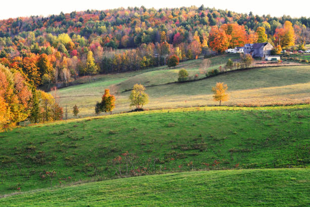
Acquiring raw land in Vermont presents a remarkable opportunity for individuals seeking custom home sites, private homesteading, timberland investments, or long-term equity growth. Known for its rolling green hills, dense maple forests, pristine river valleys, and historic mountain communities, the Green Mountain State offers a rural lifestyle combined with scenic natural beauty. Whether your vision involves constructing an off-grid cabin in the Northeast Kingdom, establishing an agricultural farm in the Champlain Valley, or building a high-end ski retreat in Southern Vermont, buying vacant land requires careful evaluation of both physical land characteristics and legal development regulations.
While purchasing unimproved land in Vermont holds significant appeal, navigating the state’s legal framework requires systematic due diligence. Vermont enforces comprehensive environmental protection laws alongside localized town zoning bylaws that dictate structural placement, road access, and parcel subdivisions. Key regulatory mechanisms, such as state wastewater permitting rules, the landmark Act 250 land-use law, and the Shoreland Protection Act, govern how land can be altered and developed. Furthermore, managing high property tax rates requires a clear understanding of state tax abatement mechanisms, including the Use Value Appraisal program. By establishing a methodical acquisition protocol, prospective land buyers can identify high-quality acreage, protect their financial capital, and avoid costly development obstacles.
Regional Geographic Sub-Markets and Terrain Across Vermont
Vermont features several distinct geographic sub-regions, each defined by unique physical terrain, economic activity, and real estate market conditions. Understanding these regional distinctions allows land buyers to match their specific lifestyle preferences or investment goals with the right geographic location.
The Champlain Valley corridor, anchored by Chittenden, Addison, and Franklin counties, represents the most populous and economically active region in the state. Featuring flat to gently rolling agricultural terrain, fertile soils, and views of Lake Champlain, this corridor commands higher land prices per acre. Demand here is driven by primary residential development, commercial farming, and proximity to Burlington’s job center. In contrast, the Central and Northern Green Mountains corridor, encompassing Washington, Lamoille, and Rutland counties, is defined by dramatic mountainous terrain, major ski resorts, and deep river valleys. Land buyers in towns near Stowe, Warren, or Killington seek custom vacation home sites, short-term rental build locations, and recreational parcels.
The Northeast Kingdom, comprising Caledonia, Essex, and Orleans counties, represents Vermont’s most remote and heavily forested territory. Offering lower per-acre land prices, vast acreage tracts, and deep isolation, the Northeast Kingdom appeals to buyers interested in commercial timber, wildlife conservation, or off-grid living. Finally, Southern Vermont, spanning Windham and Bennington counties, provides a blend of historic village centers, rolling forest land, and proximity to major metropolitan markets in Massachusetts and New York, driving strong demand for second-home acreage and luxury rural estates.
Local Municipal Town Governance and Bylaw Structures
A central element of land ownership in Vermont is the state’s traditional town meeting system and strong municipal governance structure. Land-use authority rests primarily with individual towns rather than county governments, as Vermont counties serve minimal administrative planning functions.
Every parcel of land in Vermont falls under the jurisdiction of a specific local municipality. Town selectboards, planning commissions, and development review boards draft and enforce local comprehensive plans, zoning bylaws, and subdivision regulations. These municipal bylaws establish specific rules regarding minimum lot sizes, maximum building heights, mandatory road frontage requirements, and structural setback lines from property boundaries and rights-of-way. For example, a town may require a minimum of five acres for single-family residential construction in rural agricultural districts, while allowing higher density development near historic village centers.
Because local bylaws vary significantly between adjacent municipalities, land buyers cannot assume that regulations in one town apply to another. During the due diligence process, buyers must review the official town zoning map and consult directly with the local administrative officer or zoning administrator. Confirming that your proposed land use, building footprint, driveway location, and accessory structures conform to municipal bylaws prevents unexpected zoning denial issues after closing.
Strategic Breakdown of Vermont Regional Land Markets
Evaluating primary regional land corridors across Vermont offers valuable clarity regarding target utilities, price drivers, and site constraints. The table below compares key investment corridors across the state:
| Regional Corridor | Primary Target Land Utilities | Price Drivers & Market Characteristics | Key Environmental & Regulatory Factor |
| Champlain Valley | Primary residential, commercial farming, light industrial | High population growth, Lake Champlain access, strong employment hubs | Agricultural soil preservation, municipal growth boundaries |
| Central Green Mountains | Vacation homes, resort rentals, outdoor recreation | Alpine ski proximity, scenic mountain views, luxury market demand | Steep slope restrictions, ridgeline protection bylaws |
| Northeast Kingdom | Commercial timber, off-grid cabins, wilderness conservation | Low cost per acre, vast contiguous acreage, extreme rural isolation | Off-grid infrastructure distance, seasonal road maintenance |
| Southern Vermont | Rural estates, second-home retreats, timberland | Easy access to NYC and Boston, historic village character | High municipal property tax rates, Act 250 review triggers |
Matching your property search with the appropriate regional corridor ensures that your land investment aligns with your operational budget, access preferences, and long-term development plans.
State Land-Use Oversight: Act 250 and Development Thresholds
In addition to local town zoning, prospective land buyers must understand Vermont’s landmark state land-use and development law, known as Act 250 (10 V.S.A. Chapter 151). Enacted in 1970 to preserve Vermont’s natural environment and community character, Act 250 subjects qualifying development projects to rigorous state environmental review.
Act 250 jurisdiction is triggered when a proposed project exceeds specific statutory development thresholds. Under standard rules, Act 250 review is required for commercial or industrial construction on parcels larger than ten acres in towns with permanent zoning, or on parcels larger than one acre in towns without local zoning bylaws. It also applies to housing developments or land subdivisions involving ten or more lots or units within a five-mile radius over a five-year period, as well as any construction proposed above 2,500 feet in elevation. Recent legislative reforms, including Act 181, have updated these regulatory frameworks to establish tiered jurisdictional zones and road length rules that apply to rural infrastructure development.
When a property falls under Act 250 jurisdiction, the owner must obtain an Act 250 permit from one of nine District Environmental Commissions. The application is evaluated against ten statutory environmental criteria, including impacts on soil erosion, water supply, air quality, scenic beauty, historic sites, and wildlife habitat. Existing Act 250 permits attach directly to the land’s deed permanently. Buyers purchasing land previously permitted under Act 250 must review existing permit conditions, as any structural modification or change in land use requires a formal permit amendment.
Wastewater and Potable Water Supply Regulations
In rural Vermont, where municipal public sewer and water systems are unavailable, a parcel’s buildability relies entirely on state wastewater and water supply compliance. On-lot wastewater management is regulated by the Vermont Department of Environmental Conservation under the Wastewater System and Potable Water Supply Rules.
State law requires a state wastewater and potable water supply permit for almost any new lot creation, residential building construction, or modification of existing plumbing systems. Before a permit can be issued, the land must undergo formal subsoil evaluation conducted by a licensed Licensed Designer, such as a professional engineer or site designer. The designer conducts deep test pit soil probes to assess soil texture, depth to bedrock, and seasonal high groundwater tables, followed by percolation testing to measure soil absorption speed.
If test pits reveal shallow bedrock, dense hardpan, or high groundwater levels, standard in-ground gravity septic systems will be rejected. In such cases, the site designer must design an engineered mound system, shallow in-ground system, or advanced pre-treatment unit. While these alternative systems provide reliable treatment, they require larger land footprints and increase site development costs by fifteen thousand to thirty thousand dollars. Securing a written purchase contract contingent upon obtaining a fully approved state wastewater and potable water supply permit protects buyers from acquiring unbuildable land.
Shoreland Protection Act and Ridgeline Restrictions
Vermont enforces specialized environmental standards to protect its freshwater bodies, scenic ridgelines, and mountain ecosystems from overdevelopment and soil erosion.
The Vermont Shoreland Protection Act (10 V.S.A. Chapter 49) regulates land clearing and structural development within 250 feet of the mean water level of lakes and ponds greater than ten acres in size. Within this protected shoreland zone, the law establishes strict limits on impervious surface coverage, tree removal, and building placement. Landowners must maintain a naturally vegetated buffer strip along the shoreline to prevent stormwater runoff and preserve aquatic habitat. Any construction or earth-moving activity within the 250-foot zone requires a permit or registration from the Department of Environmental Conservation.
Additionally, many Vermont towns enforce steep slope and ridgeline protection ordinances within their municipal zoning bylaws. These regulations restrict building on terrain with slopes exceeding twenty or twenty-five percent grade to prevent soil erosion, land slumping, and adverse visual impacts on mountain viewsheds. Furthermore, development activities taking place above 2,500 feet in elevation face elevated regulatory scrutiny under both local bylaws and Act 250 criteria. Buyers considering hillside or mountain properties must verify topographic contours and confirm building envelope feasibility with a licensed surveyor.
Technical and Environmental Due Diligence Matrix
Performing thorough due diligence during the contract contingency period helps land buyers identify physical limitations, legal encumbrances, and permit requirements. The table below outlines key technical variables for Vermont land purchases:
| Due Diligence Variable | Favorable Site Indicator | Elevated Risk Warning | Required Buyer Contingencies |
| State Wastewater Permit | Deep well-drained soils; passing perc test for gravity system | High seasonal water table; shallow bedrock in test pits | Obtain approved DEC Wastewater & Potable Water Permit |
| Act 250 Jurisdiction | Unencumbered parcel below statutory acreage limits | Existing Act 250 permit attached to property deed | Conduct legal title search for existing permit conditions |
| Shoreland & Wetland Status | Upland site positioned over 250 feet from water bodies | Site contains Class I or Class II state regulated wetlands | Order professional wetland delineation and buffer mapping |
| Current Use Tax Enrollment | Fully compliant UVA enrollment with up-to-date forest plan | Unrecorded forest harvest or unapproved building activity | Review town land records for Land Use Change Tax liens |
Evaluating these critical parameters early in the transaction prevents financial surprises and ensures that your construction project complies with state laws.
The Vermont Current Use Program and Property Tax Management
Property tax liabilities represent a significant annual carrying cost for land owners across Vermont. Because local tax rates are set by towns and school districts, holding large tracts of unimproved land can become expensive without state tax relief assistance.
To encourage long-term forest management and agricultural preservation, Vermont established the Use Value Appraisal program, commonly known as Current Use (32 V.S.A. Chapter 124). Under this voluntary program, eligible forestland and agricultural land is appraised for property tax purposes based on its productive forestry or agricultural value rather than its fair market development value. Enrolling land in Current Use can reduce local land tax assessment valuations by seventy to eighty percent, resulting in substantial annual carrying cost savings.
To qualify for forestland enrollment, a parcel must contain at least twenty-five contiguous acres dedicated to long-term timber management. Two acres surrounding any existing dwelling are automatically excluded from enrollment and taxed at full market value. The landowner must hire a professional forester to draft a customized Forest Management Plan approved by the Vermont Department of Forests, Parks and Recreation, which must be updated every ten years.
However, withdrawing land from the Current Use program or developing enrolled acreage triggers a mandatory Land Use Change Tax. This state tax equals ten percent of the full fair market value of the developed or withdrawn portion. The state records a contingent lien on the town land records for all enrolled properties. Buyers purchasing enrolled acreage must evaluate whether their future building plans require withdrawing land or carving out house sites prior to closing to avoid unexpected tax penalties.
Step-by-Step Acquisition Protocol for Vermont Land Buyers
Following a structured acquisition protocol helps buyers navigate legal requirements, physical site assessments, and closing procedures smoothly:
- Define Intended Use and Target Geographic Corridor: Establish your land utility goals, such as building a primary residence, constructing a ski chalet, or managing timberland, and select a target region.
- Examine Municipal Zoning bylaws and District Maps: Review local town zoning codes to confirm allowable land uses, minimum lot size requirements, road frontage rules, and structural setbacks.
- Perform GIS Environmental and Topographic Screening: Utilize Vermont ANR Natural Resources Atlas mapping tools to identify state wetlands, flood hazard zones, steep slopes, and shoreland protection buffers.
- Draft a Purchase Agreement with Critical Contingencies: Ensure your offer includes express legal contingencies for title examination, boundary survey, wastewater permitting, and Current Use verification.
- Execute On-Site Subsoil and Wastewater Testing: Hire a Licensed Designer to dig test pits, conduct percolation tests, and submit a wastewater permit application to the state DEC.
- Conduct Legal Title Examination and Access Audit: Retain a Vermont real estate attorney to verify clean title ownership, inspect deeded access easements, and search for past Act 250 permits.
- Commission a Professional Boundary Survey: Hire a licensed land surveyor to locate corner markers, map topography, locate rights-of-way, and verify building envelope boundaries.
Executing this step-by-step protocol enables prospective buyers to make informed purchasing decisions and secure fully buildable parcels.
Assembling Your Local Technical and Legal Advisory Team
Successfully buying raw land in Vermont requires assembling a skilled team of local legal, technical, and environmental professionals who understand state laws and municipal bylaws.
Your core team should be led by a licensed Vermont real estate attorney. Vermont is an attorney-closing state, meaning legal counsel conducts title searches, examines deed abstracts, drafts purchase agreements, reviews access easements, and oversees closing funds. Your attorney ensures that all necessary due diligence contingencies are properly structured in the contract to protect your earnest money deposit.
In addition to legal counsel, collaborate with key technical specialists, including a Licensed Designer, a licensed land surveyor, and a consulting forester. A Licensed Designer evaluates soils and designs compliant septic systems under state rules, while a land surveyor establishes exact property lines and maps shoreland buffers. If you are purchasing acreage enrolled in the Current Use program, retain a qualified forester to audit forest health, update management plans, and help manage state compliance requirements. Working with experienced local professionals protects your capital and ensures long-term land utility.
Conclusion
Buying land in Vermont offers exceptional potential for homebuilders, outdoor enthusiasts, agricultural producers, and real estate investors. From the fertile farm fields of the Champlain Valley to the ski corridors of the Green Mountains and the vast timberlands of the Northeast Kingdom, the state features diverse natural terrain and enduring appeal. However, unlocking a property’s true value requires navigating municipal town bylaws, securing state wastewater permits, assessing Act 250 jurisdiction, complying with shoreland protection rules, and managing Current Use tax commitments. By following a disciplined step-by-step due diligence process, verifying physical site buildability, and working alongside experienced local real estate attorneys and engineers, land buyers can acquire prime Vermont acreage, safeguard their investment, and build lasting value.
Frequently Asked Questions
How does local town zoning interact with state land-use laws in Vermont?
Vermont operates under a dual-layer regulatory framework where local towns enforce municipal zoning bylaws, while state agencies enforce environmental regulations such as Act 250 and wastewater rules. A proposed development project must satisfy both local town zoning requirements and state environmental permit standards independently before construction can begin.
What is Act 250 and when does it apply to a Vermont land purchase?
Act 250 is Vermont’s statewide land-use law that reviews large-scale development projects against ten environmental criteria. It applies to commercial construction on parcels over ten acres in zoned towns (or over one acre in unzoned towns), subdivisions creating ten or more lots, projects above 2,500 feet elevation, and certain infrastructure projects based on road length.
What permits are required for installing a private septic system on Vermont land?
Vermont requires a state Wastewater System and Potable Water Supply Permit issued by the Department of Environmental Conservation. Land must undergo subsoil evaluation and percolation testing conducted by a Licensed Designer to ensure that the soil can support a standard gravity field or an engineered alternative system.
How does the Vermont Current Use program reduce annual land property taxes?
The Use Value Appraisal (Current Use) program permits eligible forestland (minimum 25 acres) and agricultural land to be assessed for property taxes based on its productive forestry or agricultural value rather than market development value. This program reduces local land assessment values by up to eighty percent for compliant landowners.
What is the Land Use Change Tax for developing land enrolled in Current Use?
When land enrolled in the Current Use program is developed, converted to non-forest use, or withdrawn from the program, the state levies a Land Use Change Tax. This tax equals ten percent of the full fair market value of the developed or withdrawn land parcel.