
Acquiring vacant land in Rhode Island, known officially as the State of Rhode Island, offers prospective buyers a unique blend of coastal elegance, historic maritime culture, and resilient real estate value. Recognized as the Ocean State, Rhode Island features over four hundred miles of coastline, scenic tidal estuaries, pastoral agricultural fields, and upland hardwood forests. Whether your development strategy involves building a coastal residential retreat in South County, establishing an equestrian facility in Washington County, constructing a primary residence in the Providence suburban belt, or acquiring commercial acreage along major transportation corridors, purchasing raw land in Rhode Island requires a clear understanding of state environmental statutes, local municipal bylaws, and specialized coastal permitting processes.
While purchasing undeveloped property in Rhode Island provides substantial long-term equity potential and custom development opportunities, navigating the acquisition process requires rigorous site evaluation. Rhode Island is geographically compact, which intensifies competition for buildable parcels and heightens environmental regulation. Land development throughout the state is governed by a dual-agency environmental framework involving the Rhode Island Department of Environmental Management (RIDEM) and the Coastal Resources Management Council (CRMC), alongside local municipal boards across thirty-nine cities and towns. Fundamental factors such as Onsite Wastewater Treatment System (OWTS) rules, freshwater wetland buffer zones, coastal feature setback requirements, and current use property tax programs under Chapter 44-27 directly impact property buildability and ongoing ownership expenses. Implementing a structured due diligence plan enables land buyers to mitigate development risks, ensure legal compliance, and maximize their investment return.
Regional Geographic Sub-Markets and Terrain Across Rhode Island
The real estate landscape across Rhode Island is divided into distinct geographic sub-markets, each characterized by specific soil profiles, topographical features, coastal dynamics, and property valuation benchmarks. Identifying these regional variations allows land buyers to align their investment strategies with geographic realities and development budgets.
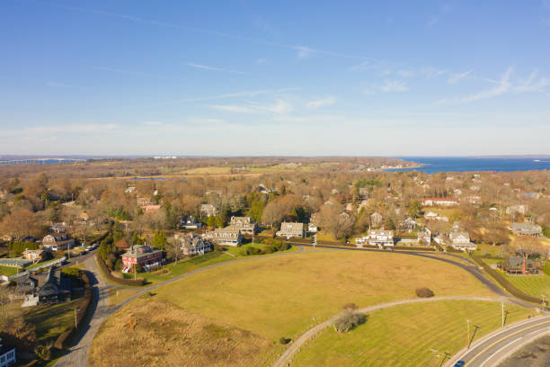
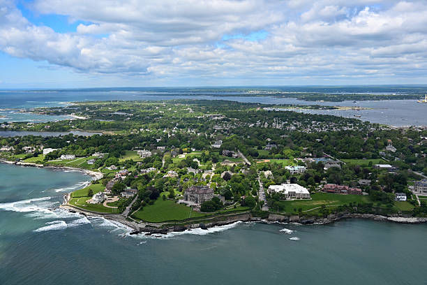
South County, comprising Washington County and towns such as Narragansett, South Kingstown, Westerly, and Charlestown, represents the flagship coastal land market in Rhode Island. Featuring barrier beaches, salt ponds, glacial outwash plains, and coastal forest, this area commands high per-acre valuations driven by strong demand for luxury secondary homes and coastal estates. Development in South County requires strict adherence to coastal zone regulations and nitrogen-sensitive wastewater management rules. East Bay, encompassing Bristol, Warren, Barrington, and Newport County on Aquidneck Island, combines historic coastal architecture with dramatic Narragansett Bay shoreline views. Land in Portsmouth, Middletown, and Newport is highly competitive, with limited vacant inventory and high per-acre prices.
Central Rhode Island and West Bay, including Kent County towns like East Greenwich, Coventry, and Warwick, provide a balance of suburban convenience and rural acreage. Rolling topography, glacial till soils, and suburban infrastructure characterize this area, making it attractive for custom single-family home development. Northern Rhode Island and the Blackstone Valley, spanning Providence County communities like Scituate, Foster, Glocester, and Burrillville, showcase the state’s most extensive forested tracts and rural terrain. Featuring rocky upland soils, dense hardwood stands, and historic agricultural lands, Northern Rhode Island offers the most affordable per-acre purchase prices in the state, appealing to buyers seeking large privacy acreage, timberland, or homestead properties.
Municipal Governance, Home Rule, and Zoning Bylaws
Understanding land development in Rhode Island requires recognizing that county governments in the state possess no administrative, legislative, or planning authority. County designations serve strictly as historical and judicial boundaries. Consequently, local land-use regulation is controlled entirely by Rhode Island’s thirty-nine individual municipal cities and towns.
Each municipality operates under home rule authority, administering local land development through municipal zoning ordinances enacted under Title 45, Chapter 24 of the Rhode Island General Laws. City councils and town councils enact local zoning ordinances, while local Planning Boards oversee land development and subdivision review under Title 45, Chapter 23. Local planning departments enforce rules governing minimum lot size, continuous road frontage along public ways, maximum lot coverage percentages, building heights, and structural setbacks from property lines. Additionally, Zoning Boards of Review possess statutory authority to hear requests for dimensional variances and special use permits when physical site conditions create practical difficulty or hardship.
Because zoning rules are established at the local level, land development regulations vary considerably across town borders. For example, a single-family home might require a minimum lot size of ten thousand square feet with seventy-five feet of frontage in a suburban West Warwick zone, while a neighboring rural zone in Foster may require a minimum of four acres and three hundred feet of road frontage. Furthermore, many towns enforce specialized overlay districts, such as Historic District Commissions, Groundwater Protection Overlay Zones, and Scenic Highway Corridors, which impose additional design criteria and environmental review steps. Consulting local building officials, town planners, and zoning officers during contract due diligence is essential to confirm site buildability.
Strategic Breakdown of Rhode Island Regional Land Markets
Evaluating primary regional land markets across Rhode Island provides essential insight regarding infrastructure, market drivers, and regulatory complexity. The table below outlines key market parameters across the primary sub-regions of the Ocean State:
| Regional Zone | Primary Target Land Utilities | Price Drivers & Market Characteristics | Key Environmental & Regulatory Factors |
| South County Coastal | Luxury coastal estates, vacation homes, resort residential | High land valuations, strong coastal demand, premium saltwater access | CRMC coastal buffers, salt pond watershed rules, OWTS nitrogen limits |
| East Bay & Aquidneck Island | Custom infill housing, coastal retreats, agricultural preservation | Limited raw land supply, high historical equity, strong buyer competition | Coastal bank erosion rules, historic district oversight, utility hookups |
| West Bay & Kent County | Suburban single-family homes, commercial infill, equestrian | Moderate per-acre pricing, excellent highway access, expanding suburbs | High seasonal groundwater, public water supply protection zones |
| Northern RI & Blackstone Valley | Rural homesteads, private forestland, commercial agriculture | Affordable purchase prices per acre, large acreage tracts, quiet living | Inland wetland buffer rules, shallow ledge bedrock, unmaintained road access |
Selecting the appropriate regional zone ensures that prospective property buyers balance capital expenditures against local regulatory schedules and infrastructure requirements.
Coastal Resources Management Council and RIDEM Freshwater Wetlands Rules
Environmental protection of land in Rhode Island operates under a dual-state agency administrative structure that is unique in New England. Jurisdiction over land alteration and environmental permitting is split between the Coastal Resources Management Council (CRMC) and the Rhode Island Department of Environmental Management (RIDEM).
The Coastal Resources Management Council holds exclusive regulatory authority over activities taking place within coastal zones, tidal waters, barrier beaches, coastal banks, salt marshes, and contiguous shoreline areas. CRMC jurisdiction extends inland two hundred feet from the inland edge of any coastal feature, such as a coastal bluff, salt marsh, or tidal waterbody. Furthermore, CRMC exercises extended jurisdiction over critical coastal watersheds, including the coastal salt ponds of South County and the Narrow River. Any proposed land clearing, grading, driveway construction, or building placement within CRMC jurisdiction requires formal application for a CRMC Assent. CRMC regulations enforce strict, non-negotiable construction setbacks and contiguous natural vegetation buffer zones designed to prevent coastal erosion, protect marine habitats, and mitigate storm surge impacts.
Inland areas beyond CRMC coastal jurisdiction fall under the authority of RIDEM under the Rhode Island Freshwater Wetlands Act. RIDEM regulates work within or adjacent to freshwater wetlands, including swamps, marshes, bogs, ponds, rivers, and intermittent streams. Under state regulations, RIDEM enforces mandatory jurisdictional buffer zones and setback distances extending from fifty feet to over two hundred feet from wetland boundaries, depending on the ecological value of the wetland resource. Proposed construction within regulated wetland buffers requires filing a Request for Preliminary Determination or a formal Application to Alter a Wetland with RIDEM. Because wetland boundary lines must be delineated during the wet season by qualified professionals, retaining a certified wetland scientist during contract due diligence is critical to establishing buildable site boundaries.
Onsite Wastewater Treatment Systems and Soil Evaluation Rules
In rural and suburban portions of Rhode Island where municipal sanitary sewer lines are absent, parcel buildability depends on obtaining state approval for an Onsite Wastewater Treatment System (OWTS), historically referred to as a septic system. OWTS design, installation, and permitting across the state are governed strictly by RIDEM under the Rules Establishing Standards for Onsite Wastewater Treatment Systems.
Before a municipal building official can issue a construction permit for raw land, the property owner must secure an approved RIDEM OWTS Suitability Determination and System Permit. Obtaining system design approval requires rigorous field testing, including deep hole soil evaluations and percolation testing. Soil evaluations must be conducted by a RIDEM-licensed soil evaluator and witnessed by a RIDEM inspector or certified municipal official. Pits are excavated to a depth of at least ten feet to analyze soil horizons, identify impermeable hardpan layers, locate shallow ledge bedrock, and establish the maximum seasonal high groundwater table elevation.
If field testing reveals shallow bedrock, tight clay soils, or elevated groundwater tables, traditional in-ground gravity septic systems will be prohibited. In such challenging site conditions, a licensed professional engineer or OWTS designer must engineer an advanced system, such as a mounded disposal area, pressurized shallow narrow drainfield, or secondary pre-treatment unit. In designated nitrogen-sensitive watersheds, such as the South County salt pond basins and public drinking water reservoir watersheds, RIDEM regulations mandate advanced nitrogen-reducing OWTS technology to protect groundwater quality. Advanced systems increase land preparation, fill importation, and equipment costs by fifteen thousand to forty thousand dollars. Securing a contract contingency requiring successful RIDEM soil evaluation and approved OWTS design protects buyers against unbuildable land purchases.
Technical and Environmental Due Diligence Matrix
Executing a structured technical due diligence process during the contract contingency period allows property buyers to systematically evaluate site risks. The table below provides an operational assessment matrix for analyzing vacant land in Rhode Island:
| Assessment Metric | Low-Risk Site Profile | Elevated Risk Warning Sign | Essential Buyer Verification Action |
| RIDEM OWTS Soil Suitability | Deep, well-drained sandy soils; low seasonal water table | High seasonal groundwater table; shallow bedrock; tight clay | Perform deep hole dig and perc test supervised by licensed soil evaluator |
| CRMC & Wetland Jurisdiction | Development envelope situated fully outside 200-foot state buffers | Property contains salt marsh, coastal bank, or freshwater swamp | Retain certified wetland scientist to flag boundaries and file for verification |
| Zoning & Road Access | Full required frontage along a town-accepted paved public road | Access relies on private right-of-way or paper road without frontage | Verify public road status with town public works and planning board |
| Chapter 44-27 Tax Status | Property clear of tax liens; current use records verified | Land enrolled without clear land use change tax agreement | Audit town assessor records for Chapter 44-27 enrollment and penalty tax liabilities |
Completing these technical evaluations ensures buyers navigate state environmental laws effectively while securing marketable property rights.
Farm, Forest, and Open Space Act (RIGL Chapter 44-27) and Tax Implications
Holding large land parcels in Rhode Island can involve significant recurring property tax liabilities if land is assessed at its full development market value. To encourage the preservation of open space, agricultural lands, and working forests, Rhode Island enacted the Farm, Forest, and Open Space Act under Chapter 44-27 of the Rhode Island General Laws.
Enrolling qualifying acreage under Chapter 44-27 allows property to be assessed for local property tax purposes based on its current use value rather than its fair market development value. This classification can reduce annual real estate tax assessments by up to eighty percent, providing substantial holding cost relief for land owners. To qualify for farmland classification, a property must generally contain a minimum of five contiguous acres actively devoted to agricultural or horticultural production and meet minimum annual gross income requirements. Forestland classification requires a minimum of ten contiguous acres, excluding the primary house site, managed under an approved written forest stewardship plan prepared by a qualified forester and certified by RIDEM. Open space classification is administered directly by the local municipal tax assessor for parcels that preserve natural resources or scenic landscapes.
However, buying land enrolled under Chapter 44-27 creates legal and tax considerations that must be addressed during transaction negotiations. If land enrolled in the program is withdrawn, sold for commercial or residential development, or converted to a non-qualifying use, it becomes subject to a Land Use Change Tax. The Land Use Change Tax is calculated as a percentage of the fair market value of the land at the time of withdrawal or conversion, sliding from ten percent during the first years of enrollment down to lower percentages over time. When purchasing enrolled land, the new owner may apply to the local tax assessor to continue the current use classification if the qualifying agricultural or forestry activity is maintained. Buyers must ensure purchase contracts explicitly define whether the seller or buyer assumes financial responsibility for Land Use Change Taxes if the land is converted for construction.
Step-by-Step Acquisition Protocol for Rhode Island Land Buyers
Adhering to a sequential acquisition protocol allows land buyers to navigate municipal bylaws, state agency approvals, and closing procedures efficiently:
- Define Property Utility and Select Target Sub-Market: Establish clear development goals, such as building a home, farming, or holding timberland, and choose a target Rhode Island community.
- Review Municipal Zoning Bylaws and Dimensional Tables: Inspect local zoning maps, setback standards, building coverage limits, and road frontage rules under Title 45 Chapter 24.
- Perform Digital GIS Environmental and Topographic Screening: Utilize RIDEM and RIGIS online mapping databases to check for public water supplies, flood zones, coastal features, and mapped wetlands.
- Draft a Purchase Contract with Technical Contingencies: Structure your purchase offer with explicit legal contingencies covering title search, boundary survey, RIDEM OWTS perc testing, and wetland approvals.
- Conduct On-Site OWTS Soil Evaluation and Deep Hole Testing: Hire a licensed soil evaluator and engineer to perform deep hole observations and perc tests supervised by RIDEM or local officials.
- Execute Field Wetland Delineation and Professional Survey: Commission a certified wetland scientist to flag wetland boundaries and retain a licensed land surveyor to map property corners and contours.
- Address Chapter 44-27 Tax Status and Legal Title Closing: Engage a Rhode Island real estate attorney to search land records, review easement rights, address current use tax classifications, and execute the closing.
Executing this structured protocol safeguards earnest money deposits and verifies site buildability prior to finalizing the acquisition.
Assembling Your Local Technical and Legal Advisory Team
Navigating the legal, environmental, and engineering complexities of buying vacant land in Rhode Island requires assembling a team of qualified local professionals familiar with state laws and municipal practices.
Your advisory team should be anchored by an experienced Rhode Island real estate attorney. Rhode Island is an attorney-closing state, meaning licensed legal counsel must perform comprehensive title searches at the municipal land evidence records, review title insurance commitments, draft purchase contract contingencies, examine access rights, and manage closing transactions. Your attorney will also audit Chapter 44-27 tax filings to ensure the property is clear of unrecorded tax liens or pending Land Use Change Tax liabilities.
In addition to legal representation, engage key technical professionals, including a licensed professional land surveyor, a RIDEM-licensed soil evaluator, a registered professional engineer, and a certified wetland scientist. A land surveyor establishes precise boundary markers, drafts recorded survey maps, and verifies physical road frontage. A licensed soil evaluator and engineer manage RIDEM OWTS testing and draft septic design plans. A certified wetland scientist delineates freshwater and coastal wetland boundaries, preparing application filings for CRMC Assent or RIDEM Wetland Permits. Working with experienced local consultants ensures your development process remains compliant, cost-effective, and on schedule.
Conclusion
Buying raw land in Rhode Island offers exceptional potential for constructing a custom residence, establishing a farming operation, or acquiring high-value coastal real estate. From the exclusive shoreline communities of South County and East Bay to the suburban towns of West Bay and the expansive woodlands of Northern Rhode Island, the Ocean State provides diverse land choices. However, successful development requires navigating municipal home rule zoning bylaws, CRMC coastal zone rules, RIDEM freshwater wetland regulations, OWTS septic requirements, and Chapter 44-27 property tax laws. By maintaining a disciplined due diligence methodology, verifying subsurface soil feasibility, confirming environmental buffer limits, and working alongside experienced local attorneys and engineers, land buyers can confidently acquire Rhode Island acreage and build long-term value.
Frequently Asked Questions
How is environmental jurisdiction divided between CRMC and RIDEM in Rhode Island?
The Coastal Resources Management Council (CRMC) holds primary regulatory jurisdiction over coastal features, tidal waters, salt marshes, and land activities extending two hundred feet inland from coastal boundaries or within designated coastal pond watersheds. The Rhode Island Department of Environmental Management (RIDEM) regulates inland freshwater wetlands, rivers, streams, forests, and state OWTS septic approvals beyond CRMC coastal zones.
What septic regulations apply when building on raw land in Rhode Island?
Onsite Wastewater Treatment Systems (OWTS) are regulated by RIDEM under state environmental rules. Raw land development requires a RIDEM OWTS Suitability Determination, which involves conducting deep hole soil evaluations and percolation testing with a licensed soil evaluator to confirm adequate soil depth, seasonal groundwater levels, and bedrock clearance.
How do local municipal zoning ordinances impact land development in Rhode Island?
County governments in Rhode Island exercise no planning or zoning power. Land use is controlled entirely by Rhode Island’s thirty-nine individual municipal cities and towns under Title 45 Chapter 24. Local planning boards and zoning enforcement officers enforce minimum lot sizes, required road frontage, building setbacks, and maximum lot coverage rules.
What is the Farm, Forest, and Open Space Act (RIGL Chapter 44-27)?
The Farm, Forest, and Open Space Act allows qualifying farmland (minimum 5 acres), forestland (minimum 10 acres), and open space land to be assessed for property tax purposes based on its current use value rather than its potential development value. Enrolling property reduces annual property taxes substantially.
What is the Land Use Change Tax in Rhode Island?
When land enrolled under the Farm, Forest, and Open Space Act is converted to residential or commercial development or withdrawn from the program, it becomes subject to a Land Use Change Tax. The tax is calculated as a percentage of the fair market value of the property at the time of conversion or withdrawal.