
Evaluating whether a vacant parcel of raw land is ready for development is one of the most critical steps in real estate acquisition, site selection, and land entitlement. Unimproved property often carries an illusion of simplicity: open terrain, scenic natural topography, and clear physical space. However, physical appearance rarely indicates true site buildability. Determining whether a parcel is development-ready requires a comprehensive investigation into legal property title, municipal zoning ordinances, environmental constraints, subsurface soil characteristics, utility access, and civil engineering requirements.
Acquiring land without conducting exhaustive technical due diligence introduces significant operational risks, unbudgeted capital expenses, and extended project delays. A parcel that appears ideal for construction may harbor hidden liabilities, such as protected freshwater wetland transition buffers, high seasonal groundwater tables, inadequate road frontage, or restrictive municipal utility moratoriums. Establishing a structured, methodical site evaluation protocol empowers real estate investors, custom homebuilders, commercial developers, and land buyers to verify property buildability, mitigate financial exposure, and execute land development projects with complete confidence.
Defining Land Development Readiness and Entitlement Stages
Understanding land development requires defining what makes a parcel legally and physically development-ready. In real estate development, property exists along a spectrum ranging from raw, un-entitled land to pad-ready, fully permitted construction sites.
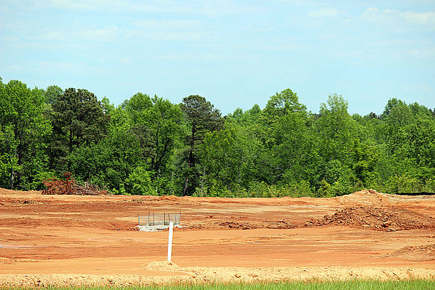
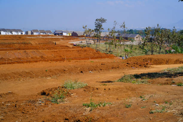
Raw land represents property in its natural state, lacking utility infrastructure, legal access improvements, and municipal building approvals. Before construction can begin, raw land must undergo site planning, environmental mapping, engineering design, and local government reviews. Conversely, pad-ready land refers to a parcel that has completed all regulatory processes. Pad-ready sites feature finished mass grading, approved municipal utility connections at the property boundary, verified public road access, completed environmental permits, and approved site plan entitlements. Construction on pad-ready land can begin almost immediately upon securing standard building permits.
The transition from raw land to a development-ready parcel requires navigating the entitlement process. Entitlement represents the legal approval framework where local planning commissions, municipal zoning boards, state environmental protection agencies, and public utility authorities grant formal authorization to develop land for a specific intended use. Determining whether a property is development-ready involves evaluating where the parcel stands within this entitlement lifecycle and identifying the exact technical steps needed to bring the site to full construction status.
Regulatory Frameworks, Zoning Bylaws, and Permitted Uses
The primary framework determining land development readiness is municipal zoning and land-use regulation. Local municipal governments enforce comprehensive zoning ordinances to control physical growth, segregate incompatible uses, manage utility capacities, and maintain community standards.
Before committing capital to a land purchase, prospective buyers must examine local zoning maps, dimensional schedules, and allowable use tables. Zoning ordinances specify permitted uses by right, conditional uses requiring special permits, and prohibited land uses within each district. Furthermore, zoning bylaws dictate strict dimensional metrics, including minimum required lot area, continuous road frontage along public streets, maximum building footprint coverage, floor area ratios, structural height caps, and mandatory property line setbacks. A parcel may possess adequate physical space for a proposed structure, yet fail to satisfy local zoning criteria due to insufficient road frontage or restrictive setback buffers.
If a proposed development does not comply fully with existing local zoning bylaws, the developer must apply for a zoning variance or a formal zoning re-classification. Obtaining a dimensional variance or use variance requires submitting engineering plans and presenting testimony at public hearings before the local Planning Board or Zoning Board of Adjustment. Securing variances introduces schedule uncertainty and public opposition risks. Verifying that a parcel’s intended utility aligns with local zoning regulations by right is a foundational indicator of land development readiness.
Technical Indicators of Land Development Readiness
Evaluating site conditions requires analyzing the physical, legal, and environmental parameters that dictate development feasibility. The table below outlines key technical metrics used to assess land readiness:
| Site Assessment Parameter | Development-Ready Indicator | High-Risk Delay Warning Sign |
| Zoning & Entitlements | Target use permitted by right; all site plan approvals secured | Requires use variance, contract re-zoning, or master plan amendment |
| Utility Accessibility | High-capacity public water, sewer, power, and gas at property line | Distant utility mains requiring off-site extensions or capacity upgrades |
| Subsurface Soil Quality | Deep, well-drained loamy soils; low water table; firm bedrock depth | High seasonal groundwater; tight clay; shallow ledge rock; uncompacted fill |
| Environmental Protection | Clear of mapped wetlands, floodways, and protected species buffers | Contains regulated wetlands, 100-year flood hazard zones, or steep slopes |
Identifying these technical indicators early enables land buyers to estimate land preparation budgets accurately and negotiate appropriate contract contingency timelines.
Environmental Constraints: Wetlands, Floodplains, and Protection Zones
Environmental regulations enforced by federal, state, and local agencies represent significant determinants of site buildability. Environmental constraints can severely restrict the buildable footprint of a parcel, regardless of total gross acreage.
Freshwater and coastal wetlands are protected under state environmental statutes and federal Army Corps of Engineers regulations. Wetlands are delineated by certified soil scientists based on soil classification, hydrology, and plant vegetation. In many jurisdictions, state laws mandate protected transition areas, or Upland Review Areas, extending fifty to two hundred feet from mapped wetland boundaries. Construction, grading, tree clearing, and pavement installation are strictly restricted within these buffer zones. A twenty-acre parcel containing extensive wetland buffers may yield only two acres of contiguous, buildable upland space.
Floodplain regulations administered under Federal Emergency Management Agency (FEMA) Flood Insurance Rate Maps impose further limits on site development. Parcels situated within designated 100-year flood hazard zones (Zone A or AE) or floodways face strict construction rules, including mandatory structural elevation, flood-proofing engineering, and restrictions against importing fill material that displaces flood storage capacity. Additionally, land buyers must screen for protected wildlife habitats, steep slope restrictions, and historic preservation overlay zones. Retaining environmental consultants to map site constraints during the contract contingency period is essential to establishing the true buildable area of a property.
Subsurface Geotechnical Investigations and Septic Soil Feasibility
Evaluating the physical earth below the surface is a vital component of site due diligence. Subsurface soil characteristics dictate structural foundation requirements, earthwork grading expenses, stormwater infiltration capacity, and on-site wastewater disposal options.
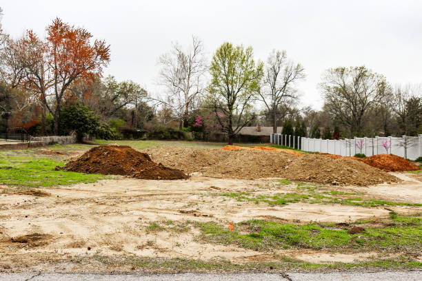
Geotechnical soil borings are conducted by licensed geotechnical engineers to evaluate the soil column and load-bearing capacity of the land. Soil borings reveal subsurface strata, identifying loose uncompacted fill, expansive clay, shallow ledge bedrock, or high seasonal groundwater tables. Shallow bedrock requires costly rock hammering or blasting during foundation excavation and utility trenching. Unstable soils or high groundwater may necessitate specialized deep foundation engineering, such as driven steel piles, helical piers, or engineered structural fill import, adding substantial costs to the project.
In suburban and rural locations lacking municipal sanitary sewer infrastructure, parcel buildability depends entirely on securing health department approvals for an on-site subsurface wastewater disposal system, or septic system. Achieving septic design approval requires conducting deep observation pit excavations and soil percolation testing supervised by local health department sanitarians. Site testing determines soil hydraulic absorption rates, depth to bedrock, and maximum seasonal groundwater elevations. If testing reveals impervious clay, tight hardpan, or elevated water tables, traditional gravity septic systems will be rejected, requiring complex engineered fill mound systems or advanced pre-treatment technology. Confirming subsurface soil feasibility is a non-negotiable step in determining land readiness.
Comparative Operational Protocols for Site Evaluation
Executing a structured, multi-phase technical evaluation ensures that land buyers verify site readiness systematically. The table below details operational action items across primary due diligence categories:
| Evaluation Phase | Specific Technical Action Item | Primary Advisory Professional |
| Legal & Title Audit | Examine land evidence records, recorded easements, title insurance, and deed covenants | Real Estate Attorney |
| Civil Engineering Review | Perform boundary survey, contour mapping, slope analysis, and road frontage checks | Licensed Professional Land Surveyor |
| Environmental Screening | Delineate wetland boundaries, analyze FEMA flood maps, check habitat databases | Certified Environmental Soil Scientist |
| Geotechnical & Utilities | Conduct deep soil borings, perc tests, and utility main capacity verifications | Geotechnical Engineer & Civil Engineer |
Completing these coordinated technical evaluations provides a complete profile of property buildability and development risk.
Utility Infrastructure Infrastructure Availability and Connection Capacity
A parcel cannot be considered development-ready without clear, verified access to essential public and private utility infrastructure. Bringing utilities to a remote or un-serviced parcel represents one of the most variable capital costs in raw land development.
Primary utility infrastructure includes domestic potable water, sanitary sewer, electrical power, natural gas, and telecommunications. When evaluating a site, land buyers must confirm not only physical utility proximity but also legal connection rights and system capacity. The presence of a public water main or sewer line running along a fronting roadway does not automatically guarantee connection authorization. Municipal utility authorities may enforce sewer allocation caps, utility connection moratoriums, or high impact fees due to treatment plant capacity limitations. If public utilities are distant, extending water and sewer mains requires constructing costly off-site infrastructure, obtaining utility easements across neighboring private properties, and securing municipal public works permits.
In rural areas lacking public infrastructure, developers must verify private utility feasibility. Water supply requires drilling private groundwater wells, which must yield adequate flow rates and meet public health drinking water quality standards. Electrical power delivery requires coordinating with local electric utility companies to establish service extension routes, select transformer locations, and determine whether high-voltage line extensions require overhead pole installations or underground conduit trenching. Identifying utility connection points, capacity constraints, and fee schedules during initial due diligence prevents budget overruns.
Legal Access, Road Frontage, and Transportation Engineering
Establishing secure, unencumbered physical and legal site access is a fundamental requirement for land development readiness. Without recognized legal access along an accepted public right-of-way, a parcel cannot obtain municipal building permits.
Municipal zoning bylaws mandate that buildable lots possess continuous frontage along an accepted public street or an approved private subdivision road. Frontage requirements vary depending on zoning density, ranging from fifty feet in urban infill districts to over three hundred feet in rural zones. Land accessed via unmaintained paper streets, private access easements, or shared driveways requires careful legal scrutiny. Constructing a building on a lot accessed via a private right-of-way often requires executing formal, recorded road maintenance agreements among adjacent property owners and obtaining authorization from the local municipal governing body.
Furthermore, connecting a site driveway or internal road network to a public roadway requires obtaining formal driveway and curb-cut permits. Driveways connecting to local municipal streets are approved by the town public works department based on sight-distance safety, driveway slope, and local drainage standards. If the property fronts a high-speed county road or state highway, access permits must be approved directly by the state Department of Transportation. Highway access permits frequently require completing formal traffic impact studies, installing dedicated turn lanes, and constructing commercial signalization to manage traffic safety.
Comprehensive Step-by-Step Land Readiness Assessment Protocol
Following a disciplined, step-by-step evaluation protocol allows land buyers to analyze site risks, manage professional consultants, and verify development readiness efficiently:
- Define Project Scope and Target Site Utility: Establish explicit development parameters, including building footprint area, target density, structural loads, utility demands, and financial return timelines.
- Review Municipal Master Plans, Zoning Maps, and Bylaws: Examine local land-use maps, allowable use schedules, setback criteria, frontage rules, and maximum building coverage limits with municipal planning staff.
- Draft a Real Estate Purchase Contract with Contingency Period: Structure purchase agreements with explicit legal contingencies allowing ninety to one hundred eighty days for technical due diligence, soil testing, and environmental mapping.
- Commission Boundary, Topographic, and ALTA/NSPS Surveys: Retain a licensed professional land surveyor to establish physical property corners, map site contours, identify utility easements, and verify legal road frontage.
- Execute On-Site Environmental Screening and Wetland Mapping: Hire certified environmental consultants to conduct field soil mapping, delineate freshwater wetlands, check FEMA flood maps, and evaluate habitat constraints.
- Perform Subsurface Geotechnical Borings and Perc Soil Testing: Engage geotechnical engineers and licensed soil evaluators to drill soil borings, conduct deep pit excavations, and execute percolation testing.
- Submit Applications for Site Plan Approval and Utility Permits: Prepare final civil engineering plans and file formal site plan applications with municipal planning boards, health departments, and utility authorities.
Adhering to this structured evaluation protocol protects earnest money deposits and confirms site buildability prior to closing the property transaction.
Assembling Your Technical, Legal, and Civil Engineering Advisory Team
Determining whether raw land is ready for development requires synthesizing complex legal, environmental, civil engineering, and municipal planning inputs. Assembling a skilled advisory team of local professionals is essential for navigating the entitlement process successfully.
Your site evaluation team should be anchored by an experienced local real estate attorney. Legal counsel performs comprehensive title searches, examines recorded utility easements, reviews deed covenants, audits current use property tax programs, negotiates contract contingency terms, and represents the applicant before local municipal planning and zoning boards.
In addition to legal counsel, engage essential technical professionals, including a licensed civil engineer, a professional land surveyor, a certified environmental soil scientist, and a geotechnical engineer. A civil engineer designs site grading, stormwater retention systems, utility layouts, and road connection profiles. A professional land surveyor prepares boundary and topographic maps required for municipal site plan submissions. An environmental soil scientist delineates wetland boundaries and files state permit applications, while a geotechnical engineer evaluates subsurface load-bearing capacity and septic soil feasibility. Working alongside experienced local consultants ensures your development process remains compliant, timely, and cost-effective.
Conclusion
Determining if raw land is ready for development requires a rigorous, multi-faceted investigation that extends far beyond visual site inspections. True development readiness is defined by a alignment of legal title clarity, supportive municipal zoning bylaws, verified subsurface soil capacity, clear environmental boundaries, direct public utility access, and secure legal road frontage. By maintaining a disciplined due diligence approach, executing thorough technical testing, securing necessary municipal entitlements, and partnering with experienced local attorneys and civil engineers, real estate investors and developers can transform raw acreage into buildable, highly valuable property assets with complete confidence.
Frequently Asked Questions
What is the difference between raw land and pad-ready land?
Raw land is un-entitled property in its natural state, lacking utility infrastructure, legal road access improvements, and municipal building approvals. Pad-ready land has completed all entitlement processes, featuring finished mass grading, approved utility hookups at the property line, verified road access, and approved site plan permits.
Why is a geotechnical soil boring test necessary when evaluating land?
Geotechnical soil borings evaluate subsurface strata to determine soil load-bearing capacity, bedrock depth, and seasonal groundwater table levels. Borings identify loose fill, expansive clay, or shallow rock that requires costly specialized foundations, blasting, or structural fill import.
How do freshwater wetlands impact land buildability?
Freshwater wetlands are protected by state and federal environmental laws. In addition to the wetland area itself, regulations enforce protected buffer transition zones (typically 50 to 200 feet) where grading, clearing, and building are restricted, reducing the total buildable upland footprint of a property.
What utility capacity factors should be verified during due diligence?
Buyers must verify physical utility proximity, legal connection rights, and municipal system capacity. Having a water or sewer line running past a property does not guarantee connection authorization if the municipal utility authority enforces capacity allocation caps or utility moratoriums.
What is a site plan entitlement?
A site plan entitlement is formal legal approval granted by a municipal planning board or zoning commission authorizing a specific development design on a parcel. Entitlements confirm that proposed building footprints, parking layouts, grading plans, utility connections, and stormwater systems comply with local land-use laws.