
Acquiring raw land in New Hampshire offers prospective property owners an unmatched combination of economic freedom, natural beauty, and long-term equity potential. Known as the Granite State, New Hampshire features a diverse geographic landscape that spans Atlantic ocean coastline, expansive lake regions, dense hardwood forests, and high-elevation alpine peaks. Whether your objective is to build a primary year-round residence, construct a recreational ski chalet, establish an off-grid homestead, or secure timberland for long-term capital preservation, purchasing unimproved real estate across New Hampshire requires a thorough evaluation of localized regulatory frameworks, physical terrain limitations, and legal property rights.
While New Hampshire is widely celebrated for its favorable tax environment, including the absence of a general state income tax or broad-based state sales tax, purchasing raw acreage presents specific technical and legal considerations. Land development across the state is governed by a decentralized system of municipal town boards alongside specific state environmental statutes administered by the New Hampshire Department of Environmental Services. Critical factors such as property access along unmaintained municipal roads, mandatory shoreland protection buffers, subsurface septic field approvals, and current use property tax abatement rules directly dictate parcel buildability and long-term holding costs. Conducting structured due diligence prior to signing a real estate contract ensures that buyers identify potential development obstacles, protect financial capital, and achieve their land ownership objectives.
Regional Geographic Sub-Markets and Terrain Across New Hampshire
The New Hampshire real estate market is organized into distinct geographic sub-regions, each characterized by specific topographical traits, economic drivers, and property valuation profiles. Matching your land search with the correct geographic zone ensures that your acquisition aligns with your intended site usage, infrastructure budget, and lifestyle requirements.
The Seacoast and Rockingham County region represents the state’s most densely populated and expensive land market. Encompassing coastal towns such as Portsmouth, Rye, and Exeter, this region features flat to rolling coastal terrain, tidal estuaries, and high market demand driven by proximity to the Boston metropolitan corridor. Further inland, the Southern Tier and Merrimack Valley corridor, including Hillsborough and Merrimack counties, serves as New Hampshire’s primary economic engine. Featuring major population centers such as Manchester, Nashua, and Concord, land in this zone commands premium prices for suburban residential subdivisions, commercial infill, and light industrial development.
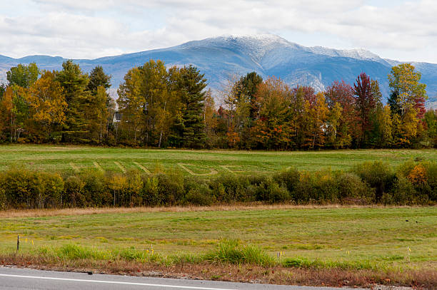
Moving northward, the Lakes Region, centered around Lake Winnipesaukee, Squam Lake, and Lake Sunapee, is defined by scenic glacial lakes, rolling forest land, and vibrant resort communities. Property buyers in Belknap and Carroll counties target waterfront parcels, elevated view lots, and vacation home sites. To the west, the Dartmouth-Lake Sunapee and Monadnock regions feature historic agricultural valleys, rolling forest tracts, and traditional rural towns. Finally, the White Mountains and Great North Woods regions, comprising Grafton and Coos counties, encompass high-elevation alpine terrain, major ski resorts, and vast industrial timberlands. Land in Coos County offers the state’s lowest per-acre purchase prices, attracting buyers seeking off-grid isolation, commercial forestry, or large-scale recreational holdings.
Local Municipal Town Governance and Zoning Authority
A fundamental aspect of purchasing real estate in New Hampshire is understanding the state’s strong tradition of municipal home rule. Local land-use authority is decentralized, placing primary regulatory control in the hands of municipal town governments rather than county administrative bodies.
Each incorporated municipality in New Hampshire establishes its own comprehensive master plan, zoning ordinances, site plan review regulations, and subdivision standards through elected or appointed local boards. Town planning boards possess broad statutory authority to regulate parcel divisions, street construction standards, and site development plans under Title LXIV of the New Hampshire Revised Statutes Annotated, encompassing RSA Chapters 672 through 677. Additionally, local Zoning Boards of Adjustment retain the authority to grant variances, special exceptions, or administrative appeals when strict application of local zoning rules imposes unnecessary hardship on a property owner.
Because municipal zoning bylaws vary dramatically between adjacent towns, prospective land buyers must verify local land-use requirements directly with municipal code officials or planning offices. Local ordinances dictate key buildability parameters, including minimum lot sizes, maximum building height limits, road frontage requirements along public highways, and structural setback distances from front, side, and rear boundary lines. A land use that is permitted by right in one town may require a lengthy special exception process or be prohibited entirely in a neighboring municipality. In unincorporated townships across Coos County where no municipal government exists, land-use planning and building permits are administered directly by the Coos County Planning Board and County Commissioners.
Strategic Breakdown of New Hampshire Regional Land Markets
Evaluating primary regional markets across New Hampshire provides essential insight into land utilities, cost factors, and environmental constraints. The table below outlines key market indicators across the state’s primary sub-regions:
| Regional Zone | Target Land Utilities | Primary Value Drivers | Key Environmental & Regulatory Considerations |
| Seacoast & Rockingham | Primary residential, suburban estates, commercial infill | High proximity to Boston, coastal access, strong job market | High per-acre land costs, strict local zoning, tidal wetland protection |
| Lakes Region & Sunapee | Waterfront homes, resort rentals, vacation retreats | Lake frontage, scenic mountain views, tourism infrastructure | Shoreland Water Quality Protection Act rules, steep slope ordinances |
| Monadnock & Central Valley | Agricultural farms, homesteads, suburban housing | Regional economic access, rolling terrain, historic town centers | Agricultural soil conservation, municipal frontage rules |
| White Mountains & North Woods | Off-grid cabins, timber management, outdoor recreation | Low cost per acre, vast contiguous tracts, deep forest access | Class VI road building rules, shallow bedrock, seasonal road limits |
Selecting the appropriate regional market ensures that property buyers align their capital resources with local land-use rules, utility infrastructure availability, and long-term site buildability.
State Environmental Oversight: SWQPA and NHDES Wetland Regulations
In addition to local town zoning, property development in New Hampshire is subject to rigorous environmental oversight by the New Hampshire Department of Environmental Services. State statutes prioritize the preservation of public water bodies, freshwater wetlands, and natural resource habitats.
Waterfront land development is strictly regulated under the Shoreland Water Quality Protection Act, set forth in RSA 483-B. The act applies to all land area located within two hundred fifty feet of the reference line of designated public waters, including coastal shorelines, great ponds greater than ten acres in size, and year-round rivers. Within this protected shoreland zone, state law mandates a fifty-foot primary building setback from the water line, restrictions on clearing native vegetation, and strict limits on the total percentage of impervious surface area permitted on the lot. Constructing buildings, installing driveways, or altering ground cover within the two hundred fifty-foot protected shoreland zone requires a formal Shoreland Permit issued by the Department of Environmental Services Land Resources Management Bureau.
Furthermore, state wetland regulations under RSA 482-A govern activities in or adjacent to freshwater wetlands, seasonal streams, and vernal pools. Landowners cannot excavate, fill, dredge, or construct roads across regulated wetland areas without obtaining a state wetlands permit. In many municipalities, local town wetlands conservation ordinances enforce local protective buffer zones ranging from fifty to one hundred feet beyond state minimum requirements. Retaining a certified wetland scientist to conduct a physical wetland delineation during your contract contingency period is necessary to establish the exact boundaries of buildable upland ground on the property.
Subsurface Wastewater Disposal and NHDES Septic Permitting
In rural areas of New Hampshire where municipal sewer lines do not extend, property buildability depends on obtaining state approval for an individual subsurface wastewater disposal system. Septic system design, installation, and permitting are governed under RSA 485-A and administered by the Department of Environmental Services Subsurface Systems Bureau.
Before a local municipality can issue a building permit for a new home, the landowner must secure formal state approvals, consisting of an Approval for Construction followed by an Approval for Operation upon system completion. System designs must be prepared by a permitted New Hampshire Septic System Designer based on physical site testing. The designer conducts deep test pit soil excavations to evaluate soil morphology, seasonal high water table indicators, and depth to ledge bedrock, accompanied by percolation rate testing to measure soil absorption capacity.
If site testing reveals high seasonal water tables, tight hardpan clay, or shallow granite bedrock, standard in-ground disposal fields cannot be permitted. The designer must engineer an elevated mounded system or utilize advanced pre-treatment technologies, which significantly increases site clearing and construction costs. Furthermore, state regulations specify mandatory setback distances, requiring septic disposal fields to be located at least seventy-five feet from private drinking water wells and surface water bodies, and ten feet from property boundary lines. Including a contract contingency that requires a successful state-approved septic design guarantees that your land purchase remains buildable.
Road Access Classifications: Class V vs. Class VI Roads and RSA 674:41
Establishing legal and physical access is a crucial component of purchasing land in New Hampshire. The state categorizes municipal public highways into six distinct classes under RSA 229:5, with Class V and Class VI highways representing the most common access designations for rural parcels.
Class V highways are town-maintained public roads that are open for year-round travel, receiving regular grading, maintenance, and municipal snowplowing services. Obtaining a building permit on a lot fronting an established Class V highway is straightforward, provided local frontage requirements are met. Conversely, Class VI highways are public highways that the municipality has discontinued maintaining, or roads that have not been maintained by the town for a period of five consecutive years or more. While Class VI highways remain public rights-of-way, the municipality assumes no obligation to maintain or plow them.
Constructing a building on a parcel served by a Class VI highway or private road is strictly governed by state statute RSA 674:41. Under this law, local building permits cannot be issued on Class VI or private roads unless the town Board of Selectmen or governing body, after consulting with the local planning board, adopts a formal policy authorizing construction on that specific road segment. Furthermore, the property owner must execute and record an official notice in the County Registry of Deeds explicitly releasing the municipality from any duty of road maintenance and acknowledging that the town is not liable for damages resulting from road condition defects. Buyers considering parcels on Class VI highways must verify whether municipal authorization can be obtained before making financial commitments.

Technical and Environmental Due Diligence Matrix
Systematic site evaluation during the purchase contract contingency period prevents costly legal disputes and construction delays. The table below provides a structured matrix of critical due diligence parameters for New Hampshire land buyers:
| Parameter | Low-Risk Site Indicator | Elevated Risk Warning Sign | Essential Buyer Verification Action |
| Municipal Road Frontage | Direct frontage on Class V town-maintained paved or gravel road | Access relies on Class VI unmaintained highway or unrecorded trail | Confirm road status with town road agent and selectmen under RSA 674:41 |
| Subsurface Septic Permitting | Deep well-drained soils with passing perc test and NHDES approval | High seasonal groundwater table or shallow granite bedrock | Hire permitted designer to dig test pits and draft NHDES application |
| Shoreland Protection Act (RSA 483-B) | Proposed structure positioned more than 250 feet from surface water | Building envelope located within 50-foot primary setback zone | Consult NHDES shoreland mapping and submit formal permit application |
| Property Tax Status (RSA 79-A) | Unencumbered parcel or clear land withdrawal plan established | Unrecorded land clearing or missing forestry management compliance | Audit town tax records for Current Use status and potential penalty liens |
Completing these verification steps ensures that property owners navigate state statutes effectively while securing clear, marketable title rights.
The New Hampshire Current Use Program (RSA 79-A) and Property Tax Strategy
Property tax obligations represent an ongoing financial liability for landowners in New Hampshire. Because the state relies heavily on local real estate taxes to fund municipal services and public schools, holding large tracts of unimproved land can generate substantial annual carrying costs unless tax relief programs are utilized.
To prevent the conversion of open space land to suburban development, New Hampshire established the Current Use Program under RSA 79-A. Current Use is the foundation of land conservation in the state, with over half of New Hampshire’s total land area currently enrolled. Under this program, qualifying open space land is assessed for real estate tax purposes based on its current income-producing capacity as managed forestland, farmland, or unmanaged open space, rather than its full fair market development value. Enrolling qualifying land in Current Use can reduce local property tax assessments by eighty to ninety percent, dramatically lowering annual carrying costs.
To qualify for Current Use assessment, a parcel must contain at least ten contiguous acres of open space land dedicated to forest management, agriculture, or wild land. Parcels under ten acres may qualify if they generate a minimum of twenty-five hundred dollars in annual gross agricultural income. However, converting enrolled land to a non-qualifying use, such as constructing a house, clearing a building lot, or establishing a commercial site, triggers a mandatory Land Use Change Tax under RSA 79-A:7. The tax is assessed at ten percent of the full, unadjusted market value of the developed land portion as of the date the land use changes. Buyers purchasing enrolled land must carefully calculate potential Land Use Change Tax liabilities before clearing trees or building structures.
Step-by-Step Acquisition Protocol for New Hampshire Land Buyers
Executing a disciplined, step-by-step acquisition protocol helps land buyers navigate complex local zoning codes, state environmental statutes, and closing procedures safely:
- Define Project Utility and Target Sub-Region: Determine your intended land usage, such as building a year-round home, constructing a vacation cabin, or managing a timber parcel, and select a target region.
- Verify Municipal Zoning Bylaws and Road Access: Review local town zoning maps, frontage requirements, building setbacks, and road classifications under RSA 229:5 and RSA 674:41 with local planning officials.
- Conduct Environmental GIS Screening and Mapping: Utilize state Department of Environmental Services mapping software to inspect wetlands, surface water features, steep topography, and shoreland protection zones under RSA 483-B.
- Execute a Purchase Agreement with Strict Contingencies: Ensure your real estate contract includes express contingencies for title examination, boundary surveying, state septic permitting, and Current Use tax auditing.
- Perform On-Site Subsurface Septic Soil Testing: Hire a permitted New Hampshire Septic System Designer to dig soil test pits, measure percolation rates, and submit an NHDES septic design application.
- Retain a Real Estate Attorney for Title and Easement Review: Engage an experienced New Hampshire real estate attorney to examine registry deed abstracts, verify recorded legal access easements, and search for municipal tax liens.
- Commission a Licensed Land Surveyor for Boundary Verification: Hire a licensed land surveyor to locate corner pins, map topography, establish building envelopes, and confirm boundary dimensions.
Following this sequential process minimizes financial exposure and ensures that your land purchase meets all legal buildability criteria.

Assembling Your Local Technical and Legal Advisory Team
Navigating the legal, environmental, and engineering requirements of a raw land transaction in New Hampshire requires assembling a qualified team of local professionals who possess specialized knowledge of state statutes and local town practices.
Your core team should be anchored by a licensed New Hampshire real estate attorney. New Hampshire property conveyances involve complex legal issues regarding deed covenants, rights-of-way, Class VI road approvals, and Current Use tax liens. Your attorney will review purchase contracts, draft custom due diligence contingencies, conduct title searches at the County Registry of Deeds, and ensure that closing documents convey clean, marketable title.
In addition to legal representation, work closely with key technical service providers, including a permitted New Hampshire Septic System Designer, a licensed land surveyor, and a certified wetland scientist. A permitted septic designer manages soil pit testing and submits design applications to NHDES under RSA 485-A. A licensed land surveyor establishes physical boundary corner markers and maps shoreland setbacks, while a certified wetland scientist delineates protected wetland boundaries. If purchasing forested land enrolled in RSA 79-A, consult a licensed professional forester to audit timber health and ensure program compliance. Working alongside qualified local experts safeguards your capital investment.
Conclusion
Buying land in New Hampshire provides an exceptional opportunity to build a custom residence, establish a rural retreat, or secure long-term real estate equity in a tax-friendly state. From the coastal communities of the Seacoast to the mountain vistas of the White Mountains and the secluded forests of the Great North Woods, New Hampshire offers diverse terrain and strong land value. However, securing a successful outcome requires thorough due diligence regarding municipal home rule zoning, NHDES subsurface septic permitting, Shoreland Water Quality Protection Act rules, Class VI road access statutes under RSA 674:41, and Current Use tax obligations under RSA 79-A. By following a structured step-by-step acquisition protocol and partnering with experienced local attorneys, surveyors, and environmental consultants, land buyers can successfully acquire prime New Hampshire acreage and build lasting property value.
Frequently Asked Questions
What is the significance of RSA 674:41 when buying land on an unmaintained road in New Hampshire?
RSA 674:41 is a state statute that strictly regulates building construction on Class VI unmaintained highways and private roads. Municipalities cannot issue building permits on these roads unless the local Board of Selectmen, after consulting with the planning board, votes to permit construction. Additionally, the property owner must record a formal release of municipal liability in the Registry of Deeds.
How does the Shoreland Water Quality Protection Act impact waterfront property in New Hampshire?
The Shoreland Water Quality Protection Act (RSA 483-B) regulates land development within two hundred fifty feet of protected surface waters, including lakes, coastal shorelines, and major rivers. The statute establishes a fifty-foot primary building setback, restricts tree clearing, limits impervious surfaces, and requires an NHDES Shoreland Permit before earth-moving or construction begins.
What permits are required to install a septic system on raw land in New Hampshire?
Under RSA 485-A, installing a septic system requires formal review by the NHDES Subsurface Systems Bureau. A permitted septic designer must conduct on-site test pit soil evaluations and percolation tests to design a compliant disposal field. The state must issue an Approval for Construction before installation begins, followed by an Approval for Operation upon final inspection.
How does the Current Use Program (RSA 79-A) lower annual property taxes in New Hampshire?
The Current Use Program allows qualifying open space parcels of ten or more acres to be assessed for property taxes based on open space income capacity rather than full market value. Enrolling land can lower annual property tax assessments by eighty to ninety percent, provided the land remains undeveloped and dedicated to forestry, farming, or open space.
What triggers the Land Use Change Tax under New Hampshire Current Use rules?
The Land Use Change Tax is triggered when land enrolled in Current Use is physically altered for non-qualifying development, such as building a home, constructing commercial facilities, or creating a residential subdivision lot. The town levies a mandatory tax equal to ten percent of the full, unadjusted market value of the developed land portion as of the date the land use changes.