
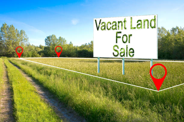
Buying vacant land in the Northeast offers unmatched opportunities, whether your dream is building an off-grid cabin in Maine, starting a homestead in Vermont, or developing a custom rural retreat in Upstate New York. However, purchasing raw ground in this region comes with distinct regulatory, environmental, and geographical complexities. Unlike purchasing existing homes, acquiring undeveloped land requires deep due diligence into municipal zoning, soil percolation rates, seasonal access, and utility extension costs. To make a safe and profitable investment, you must evaluate both physical site characteristics and local regulatory frameworks. This comprehensive guide walks you step-by-step through every phase of the buying process, detailing soil testing, water rights, financing, tax incentive programs, and legal protections tailored specifically to the Northeastern landscape.
Mapping the Northeast Land Market
The Northeastern land market encompasses a rich variety of micro-regions, ranging from the rocky coastal terrain of Down East Maine and the granite hills of New Hampshire to the fertile river valleys of Pennsylvania and the agricultural plateaus of Upstate New York. Each region presents its own microclimate, soil structure, and regulatory environment. Understanding regional nuances helps you narrow your search based on your budget and goals. Northern New England offers vast tracts of forested timberland at lower price points per acre, but often comes with strict seasonal access constraints and heavy snow loads. Southern New England features higher land costs per acre and stringent local conservation commission oversight, but provides closer proximity to major metropolitan centers and developed utility infrastructure.
When evaluating regional markets, coordinate directly with local land management authorities. Agencies such as the USDA Natural Resources Conservation Service Regional Offices provide critical soil data, while state land offices, such as the Maine Forest Service Headquarters in Augusta or the Pennsylvania Department of Conservation and Natural Resources in Harrisburg, offer regional land maps, timber assessment tools, and comprehensive land management assistance for new property buyers.
Determining Your Intended Use and Land Classification
Before searching for parcels, you must clearly define your intended property use. Land in the Northeast is generally categorized into three main development stages: raw land, unimproved land, and improved land. Raw land represents entirely undeveloped parcels with no utility hookups, no drilled well, no septic approval, and no established road access. Raw land carries the lowest initial purchase price but requires significant capital expenditure for infrastructure development. Unimproved land features basic infrastructure, such as rough driveway access, cleared building envelopes, or nearby power lines, but lacks full utility connections or finished building permits. Improved land provides a fully prepared site with driveways, power at the lot line, a passing percolation test, and often an active septic design or drilled well in place.
Your primary use, whether building a primary residence, establishing a commercial farm, creating a seasonal hunting camp, or holding timber for investment, dictates which classification you should target. Each use triggers different municipal zoning rules, setback rules, and building codes that govern how the land can be altered. Defining these parameters early prevents expensive delays later.

Comprehensive Regional Cost Breakdown by State
Land prices, property tax burdens, and permitting rules vary widely across Northeastern states. The table below outlines average costs, primary zoning hurdles, and key regulatory agencies across major Northeast land markets:
| State | Avg Price Range per Acre (Rural) | Primary Zoning & Environmental Hurdle | Property Tax Load | Primary Oversight Office |
| Maine | $1,500 to $4,500 | LUPC Unorganized Territories & Shoreland Zoning | Moderate | Maine Land Use Planning Commission |
| Vermont | $3,500 to $8,500 | Act 250 Land Use Regulations & Steep Slope Restrictions | High | VT Natural Resources Board |
| New Hampshire | $3,000 to $7,500 | Wetlands Bureau Permitting & Current Use Penalties | High | NH Department of Environmental Services |
| New York (Upstate) | $2,500 to $6,500 | Adirondack Park Agency & DEC Freshwater Wetlands | Moderate to High | NYS Dept. of Environmental Conservation |
| Pennsylvania | $3,000 to $7,000 | Sewage Facilities Act & High Water Tables | Moderate | PA Dept. of Environmental Protection |
| Massachusetts | $8,000 to $20,000+ | Wetlands Protection Act & Local Conservation | High | MA Executive Office of Energy & Environment |
When reviewing properties in these states, contact the corresponding county tax assessor office and registry of deeds, such as the Erie County Registry of Deeds in Buffalo, New York or the Penobscot County Registry of Deeds in Bangor, Maine, to confirm current assessment rates, tax histories, and recorded parcel maps.
Mastering Local Zoning Laws and Municipal Codes
In the Northeast, local municipal governance is exceptionally strong. Most towns govern land use through local planning boards, zoning boards of adjustment, and building departments. Never assume that because a piece of land is located in a rural area, you can build whatever you want without explicit municipal authorization.
- Minimum Lot Size: Many rural Northeastern towns enforce minimum lot size requirements, often ranging from two to five or more acres, to construct a single-family dwelling.
- Road Frontage Requirements: Towns frequently require a minimum continuous frontage, often 150 to 300 feet, along an approved, town-maintained public road.
- Setbacks: Structures, wells, and septic fields must maintain specific distances from front property lines, side or rear boundaries, and surface water bodies.
- Building Envelope Restrictions: Towns may limit construction to specific designated zones on the parcel to preserve ridgelines, agricultural soils, or wildlife corridors.
Before submitting an offer, schedule a pre-application consultation with the local Town Municipal Planning Board Office or Code Enforcement Officer. Review the town’s official zoning ordinance and land use maps, which are typically made available online through town municipal portals or physically at the local town hall.
Navigating Environmental Regulations and Wetland Protections
Northeastern states enforce rigorous environmental protection standards to safeguard watersheds, river basins, and coastal habitats. Wetlands, seasonal streams, and vernal pools significantly impact a parcel’s buildable footprint. Most Northeast jurisdictions mandate protected buffer zones ranging from 50 to 100 or more feet surrounding delineated wetlands where no clearing, grading, or building can occur under state law. In states like Massachusetts and Connecticut, local Conservation Commissions possess strict statutory authority under state wetland protection acts to review and deny development plans impacting water resource areas.
In Upstate New York, land within the six-million-acre Adirondack Park is strictly categorized by the Adirondack Park Agency Regional Office in Ray Brook, New York, limiting build density and tree clearing limits. Similarly, Maine’s Mandatory Shoreland Zoning Act regulates all land areas within 250 feet of ponds, lakes, rivers, and tidal waters, strictly restricting vegetation removal, soil disturbance, and foundation types.
Performing Critical Due Diligence: Perc Testing and Septic Approval
In rural areas without municipal sewer connections, your ability to build depends directly on obtaining septic system approval. This requires a percolation test, commonly called a perc test, and a deep-hole soil evaluation conducted by a licensed soil scientist or professional engineer. A perc test measures how rapidly water drains through the soil profile. Soil with high clay content drains too slowly, while excessively coarse gravel or shallow bedrock prevents proper biological filtration of wastewater.
If a property fails a standard perc test due to high seasonal water tables or shallow ledge, you may need an engineered septic system, such as a raised mound system or aerobic treatment unit. Engineered systems can add $15,000 to $35,000 or more to your site preparation costs compared to a conventional gravity-fed system. Always include a formal perc test contingency in your land purchase contract, allowing you to perform soil testing verified by the local health officer before closing on the property.
Water Infrastructure: Wells, Aquifers, and Riparian Rights
Access to clean, reliable water is essential for raw land development. In rural Northeastern locations, this typically requires drilling a private groundwater well into bedrock formations. Drilled bedrock wells are the industry standard across the Northeast, penetrating anywhere from 100 to 500 or more feet into underlying granite or shale formations to intercept water-bearing fractures. Key metrics to verify during due diligence include the flow rate measured in gallons per minute, the static water level down to the water table, and overall water quality regarding iron, manganese, or hard minerals. A standard residential home requires a sustained yield of at least three to five gallons per minute.
Consult well-drilling logs maintained by state geological surveys, such as the New York State Water Well Program or the Maine Geological Survey Well Database, to evaluate average well depths and water yields in your immediate vicinity before buying land.
Utility Access and Off-Grid Infrastructure Costs
Bringing grid electric, high-speed internet, and physical utilities to a vacant land parcel can quickly exceed the initial purchase price if the lines must run significant distances from the nearest main line.
| Infrastructure Component | Average Cost Range | Key Factors & Variables | Primary Regional Approving Body |
| Grid Power Extension | $25 to $50 per linear foot | Pole placement, ledge blasting, transformer drop | Local Electric Utility |
| Private Drilled Well | $5,000 to $12,000 | Depth to aquifer, casing length, pump size | State Department of Health |
| Conventional Septic System | $8,000 to $15,000 | Soil absorption, tank size, leach field design | County Health Department |
| Engineered Septic System | $18,000 to $35,000+ | Raised mound, sand filter, pump chamber | State Environmental Protection Agency |
| Gravel Driveway Construction | $15 to $35 per linear foot | Culverts, geotextile fabric, grading, slope | Town Road Commissioner |
If utility extension costs are prohibitive, evaluate off-grid solar power systems with lithium battery storage banks. Solar feasibility requires evaluating solar access, timber clearing requirements, and winter power generation capacity across the Northeast’s low-sunlight winter months.
Access Rights, Road Frontage, and Easements
A critical step in evaluating vacant land is confirming legal, unencumbered physical and legal access. Never purchase land assuming you can cross a neighbor’s property or use an unimproved woods trail without documented, recorded legal rights.
- Class 6 / Discontinued Roads: In states like New Hampshire and Vermont, many rural roads are classified as Class 6 unmaintained town highways. Towns are not obligated to plow, repair, or maintain Class 6 roads, and building permits are often restricted or denied on them without specific selectboard approval.
- Deeded Rights-of-Way: Ensure any access easement is explicitly written into the property deed recorded at the county registry of deeds, specifying width, allowed uses for utilities and ingress or egress, and maintenance burden sharing.
- Private Road Maintenance Agreements: If the parcel is accessed via a shared private road, verify whether a formal road association or legally binding maintenance agreement exists among landowners to cover snowplowing, grading, and gravel repair.
- Landlocked Parcels: Avoid purchasing landlocked acreage unless an appurtenant access easement is secured, mapped by a licensed land surveyor, and recorded prior to or at closing.
Property Surveys, Boundaries, and Historic Encroachments
Boundary disputes are common in the Northeast due to historical property descriptions that rely on natural landmarks, such as stone walls, large oak trees, or iron pins set over a century ago. A Boundary Survey conducted by a Professional Land Surveyor licensed in the state is essential. The surveyor will locate historical monuments, re-establish legal boundaries, set clear corner stakes, and produce a recordable plan.
Surveying protects you against adverse possession claims, where neighboring landowners claim ownership of land through prolonged, open use, and ensures that existing structures, fences, or logging roads do not encroach on adjoining parcels. Always insist on a freshly recorded boundary survey as a strict condition of your purchase contract.
Financing Options for Raw Land in the Northeast
Traditional residential mortgage lenders rarely provide long-term financing for raw, unimproved land because there is no immediate dwelling serving as collateral. Standard financing avenues require specialized approaches. Institutions within the national Farm Credit System, such as Farm Credit East headquartered in Enfield, Connecticut, or AgChoice Farm Credit, specialize in rural land, farm, and timberland financing across the Northeast. They offer long-term fixed rates tailored for bare acreage, homesteads, and country properties.
Regional community banks and credit unions frequently hold land loans in their portfolio, with down payment requirements ranging from 20 percent to 40 percent and loan terms between 10 and 20 years. Land buyers can also negotiate seller financing directly, allowing for lower closing costs and flexible underwriting terms. If building immediately, a single-close construction-to-permanent loan combines land purchase and building costs into one package.
Evaluating Soil Quality, Topography, and Timber Value
A parcel’s natural features determine where you can build, how much site clearing will cost, and whether the land can generate immediate or long-term income. Topography directly impacts construction costs, as land with slopes exceeding 15 percent requires expensive grading, specialized foundation engineering, and extensive erosion control measures during site development. Review soil maps using the USDA Natural Resources Conservation Service Web Soil Survey to find fertile loamy soils for homesteading and identify deep clay or dense hardpan layers that inhibit drainage.
Exposed granite ledge or shallow bedrock requires expensive hydraulic hammering or blasting for foundation excavation, well drilling, and utility trenching. Conversely, high-value hardwood stands, such as sugar maple, black cherry, and red oak, or softwood stands, such as white pine and spruce, can offer immediate timber harvest revenue to offset land acquisition costs. Consult a certified consulting forester to cruise the timber before making a formal offer.
Navigating Tax Incentives, Current Use Programs, and Conservation Easements
To keep holding costs low on large parcels, Northeastern states offer preferential property tax assessment programs, commonly known as Current Use or Agricultural Assessment programs. These programs assess land based on its current productive use rather than its full market development value, often reducing annual property taxes by 50 percent to 90 percent.
| State Program Name | Minimum Acreage Required | Primary Qualified Land Types | Early Withdrawal Penalty | Administering Office |
| VT Use Value Appraisal | 27 contiguous acres | Managed Forestland, Active Farmland | Land Use Change Tax | VT Dept. of Taxes |
| NH Current Use Program | 10 contiguous acres | Forest, Farmland, Unmanaged Open Space | Land Use Change Tax | NH Current Use Board |
| NY Agricultural Assessment | 7 acres + gross sales | Commercial Agriculture, Crops, Livestock | Rollback Taxes plus interest | NYS Dept. of Taxation & Finance |
| PA Clean and Green | 10 acres or income | Agricultural, Forest Reserve, Open Space | Rollback Taxes for past 7 years | County Assessment Office |
| ME Tree Growth Tax Law | 10 acres of forest | Managed Forestland with Forest Plan | Penalty based on fair market value | Maine Revenue Services |
Enrolling in current use requires committing to long-term land preservation or active management, often under a written forest management plan prepared by a licensed forester. Removing land from current use to build a home triggers early withdrawal penalties, so plan building envelopes carefully.

Title Searches, Insurance, and Deed Restrictions
Before finalizing a land purchase, hire a real estate attorney or title company to perform a title search going back 50 to 60 or more years. Confirm that subsurface mineral, oil, gas, timber, and water rights are fully intact and convey with the surface deed, rather than having been severed by prior owners decades ago. Review historical deeds for restrictive covenants that prohibit specific uses, limit mobile homes or livestock, or dictate minimum building square footages.
You should also look for evidence of unrecorded utility lines, snowmobile trail rights, or neighbor access paths across the land. Always purchase an Owner’s Policy of Title Insurance to protect your financial investment against unrecorded liens, boundary overlaps, or historical chain-of-title defects.
Seasonal Accessibility and Northeast Winter Logistics
The Northeast’s distinct four-season climate brings severe winter conditions, heavy snowfall, frost heaves, and spring mud seasons that impact building projects and site access. During the spring thaw, typically March through May, local towns enforce heavy weight limits on rural gravel roads, preventing dump trucks, concrete mixers, and heavy excavators from reaching your site. Building codes across the Northeast require concrete footings to extend below the deep frost line, typically 48 to 60 inches below grade, to prevent frost-heaving damage.
Ensure proposed driveway routes do not exceed a 10 percent grade, as steeper slopes become dangerous in winter ice storms and make snow plowing difficult. Finally, plan your site layout with ample designated space along driveways and parking areas to stack plowed snow during harsh winter storms.
Conclusion
Purchasing vacant land in the Northeast is a deeply rewarding venture that allows you to secure a piece of country living, build a custom home, or establish a long-term investment property. However, the key to a successful transaction lies in thorough due diligence before closing. By systematically evaluating local zoning bylaws, performing soil percolation tests, confirming deeded road access, and accounting for utility extension expenses, you eliminate costly surprises and safeguard your financial investment. Work closely with experienced local professionals, including licensed land surveyors, soil scientists, real estate attorneys, and specialized rural lenders, to guide you through every regulatory step. With a clear strategy and a solid understanding of Northeastern land dynamics, you can confidently turn your vision of land ownership into reality.
Frequently Asked Questions
What is the difference between a perc test and a soil test?
A perc test, short for percolation test, specifically evaluates how fast water drains through soil to determine whether the ground can support a standard septic drain field. A structural soil test, also called a geotechnical test, evaluates the load-bearing capacity, compaction, and density of the soil to ensure it can safely support a building foundation without settling or shifting over time. While a perc test is governed by local health departments for wastewater management, geotechnical soil tests are used by structural engineers during foundation design.
Can I camp or park an RV on vacant land while preparing to build?
Camping and RV rules vary significantly by town. Many rural Northeastern municipalities allow temporary camping or RV living for 30 to 90 days per year, provided the vehicle is self-contained. However, many towns strictly prohibit living in an RV on vacant land long-term without an active building permit, a potable water source, and an approved septic connection. Always check local town zoning ordinances and municipal land-use bylaws before bringing an RV onto raw land.
How much does it cost to clear raw land for a house site?
Clearing and site preparation costs in the Northeast typically range from $3,000 to $10,000 per acre for light brush and small timber, and up to $10,000 to $20,000 or more per acre for dense, mature forest with steep slopes or large boulders. Total clearing costs depend on timber density, stump removal, rock excavation, grading needs, and whether you can sell the harvested timber to offset logging expenses.
What happens if I buy land enrolled in a Current Use tax program?
When you purchase land enrolled in a state Current Use or Agricultural Assessment program, the land remains in the program unless you formally withdraw it. If you intend to build on a portion of the land, you must work with the town assessor and state tax department to withdraw that specific building envelope, typically one to two acres, which triggers an early withdrawal tax penalty. The remaining qualifying acreage can stay enrolled in the program to maintain low annual holding taxes.
How do I verify that a rural land parcel has reliable internet access?
Do not rely on regional coverage maps provided by service providers. To verify internet availability, obtain the physical address of the nearest neighbor or the nearest utility pole number directly outside the parcel. Contact local service providers, such as Spectrum, Comcast Xfinity, Consolidated Communications, or regional fiber cooperatives, and request a formal serviceability check. If wired broadband is unavailable, evaluate satellite options like Starlink or fixed wireless providers operating in the area.